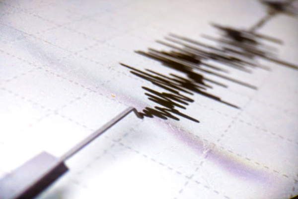
A powerful 7.7-magnitude earthquake off Indonesia’s Flores region on August 15 struck at 5:58 am local time at a depth of about 10 kilometres, with its epicentre about 68 kilometres (42 miles) north-northwest of Ende in East Nusa Tenggara, according to the US Geological Survey (USGS). Indonesia’s disaster management agency said at least 51 people were killed, while dozens more were injured.
The earthquake triggered a tsunami warning along parts of Indonesia’s eastern coast. The warning was later lifted after monitoring showed no significant continuing threat, although the Indonesian meteorological agency recorded small tsunami waves in several coastal areas.
In what may seem to be an unrelated incident, the confirmed death toll from the powerful magnitude 7.4 earthquake that struck Colombia on August 10 climbed to 285 on Friday, while 379 people remained missing and rescue crews pressed on with increasingly difficult searches for survivors four days after the disaster.
The latest figures from Colombia’s National Unit for Disaster Risk Management show the enormous reach of the emergency: 3,975 people have been injured, 45,523 families affected and 12,828 homes destroyed. Authorities said another 73,455 homes sustained damage. That number is still being adjusted as engineering teams carry out on-site inspections to determine the actual condition of properties across the disaster zone.
The earthquake struck at 7:34 a.m. Monday near San José del Palmar in the Pacific department of Chocó, sending powerful tremors across western and central Colombia and leaving a trail of destruction that authorities are still assessing.
Seemingly unrelated, and yet, if you look at a map of the last day of earthquakes — any day — one shape appears before any other: a huge horseshoe wrapped around the Pacific Ocean. As liveearthviewer.com explains, geologists call it the Ring of Fire, and it is the single most active earthquake and volcano horseshoe-shaped belt on Earth. According to the USGS, about 90% of the world’s earthquakes happen along it, and roughly 75% of Earth’s active volcanoes stand on it.
The Ring is a Chain of Separate Plate Boundaries
The Ring of Fire is not one crack in the planet. It is a chain of separate plate boundaries — most of them subduction zones — that happen to trace the rim of one ocean, for roughly 40,000 kilometres (about 25,000 miles, USGS). Around most of the Pacific’s edge, the ocean floor is being consumed: dense oceanic plates (the Pacific Plate and its smaller neighbours like the Nazca, Cocos, Juan de Fuca and Philippine Sea plates) are bending down and sliding beneath the plates beside them.
Where a plate goes down, two things follow. The descent is not smooth — the plates lock, strain builds for decades or centuries, and then releases in an instant. That is an earthquake, and subduction zones produce the biggest ones on record: the largest earthquake ever measured, the magnitude 9.5 Valdivia earthquake in Chile in 1960 (USGS), broke on exactly this kind of boundary, as did the 2011 Tōhoku and 2004 Sumatra events.
And as the sinking slab heats up, it releases water into the hot rock above it, lowering that rock’s melting point. Molten rock rises, and a chain of volcanoes grows at the surface, set back a little from the trench. That is why the ring’s volcanoes come in arcs — the Andes, the Cascades, the Aleutians, the Japanese islands — each arc paired with the trench offshore that feeds it.
The Features of the Horseshoe
Working around the horseshoe, the Ring of Fire is made of features with their own names, many of which appear on the map’s plate-boundary layer:
The Peru–Chile Trench runs the length of South America’s west coast, where the Nazca Plate dives under the continent and lifts the Andes — the ring’s longest volcanic mountain chain. Central America and Mexico continue the line along the Middle America Trench. In the Pacific Northwest, the small Juan de Fuca Plate subducts along the Cascadia margin, feeding the Cascade volcanoes — Mount St. Helens, Rainier, Shasta. Alaska’s Aleutian Trench and its island arc carry the ring west across the top of the Pacific.
Down the western side: Russia’s Kamchatka Peninsula and the Kuril Trench, then the Japan Trench — source of the 2011 magnitude 9.1 Tōhoku earthquake (USGS) — then the Mariana Trench, the deepest place in the ocean at nearly 11 kilometres down (NOAA). The line continues through the Philippines and Indonesia — home to more volcanoes than any other country on the ring — and closes out through the Tonga–Kermadec Trench to New Zealand.
Why the Ring Lights Up a Map
The remarkable thing about the Ring of Fire is that you don’t need a textbook diagram to see it — the planet redraws it for you, daily. The map’s Earthquakes layer shows the last 24 hours of USGS-reported quakes, and on almost any day the majority of the dots land on the ring’s arcs. The Plate Boundaries & Faults layer underneath shows why: the warm, heavy lines are the subduction trenches, and the dots cluster along them because that is where the strain is being released, right now.
That pairing — the structural lines and today’s actual earthquakes on one globe — is the whole demonstration. The 90% figure stops being a statistic and becomes something you can check against this morning’s data.
The volcano markers on the live globe are the USGS alert-level volcanoes — the US-monitored set in Alaska, the Cascades, Hawaii, California and the Marianas, each coloured by its current aviation alert code. That is one well-instrumented segment of the ring, not the whole ring: the full global picture, all 1,200+ volcanoes in the Smithsonian Global Volcanism Program catalogue, has its own map on the Atlas volcanoes page.
The Ring of Fire has a Wide Reach
As The Indian Express reports, the Ring of Fire extends through some of the world’s most earthquake-prone countries and territories, including Japan, the Philippines, Indonesia, New Zealand, Alaska, the western United States, Mexico, Central America and the western coast of South America.
The USGS says the belt stretches along the rim of the Pacific and contains the boundaries of several tectonic plates. That geography explains why major earthquakes can occur in countries separated by thousands of kilometres but still share a common tectonic setting.
Japan, for example, sits at a complex meeting point of several plates and has experienced some of the world’s most destructive earthquakes, including the 2011 Tohoku earthquake and tsunami.
Why is the Ring of Fire so active?
The answer lies in plate tectonics. Earth’s outer shell is divided into large tectonic plates that are constantly moving. Around the Pacific, several of these plates interact along boundaries where they collide, slide past each other or pull apart.
One of the most important processes is subduction. At a subduction zone, a denser oceanic plate is forced beneath another plate. Stress can accumulate along the boundary and eventually be released as a powerful earthquake. Subduction can also generate magma, which helps explain the large number of volcanoes found around the Pacific.
The USGS describes the Ring of Fire as a zone of frequent earthquakes and volcanic eruptions associated with volcanic arcs and deep ocean trenches around the Pacific Basin.
Debunking Myths
So, is the Ring of Fire waking up? Not necessarily. The recent earthquakes in Indonesia and Colombia occurred in a region known for frequent seismic activity, but their close timing does not by itself mean they are connected or that the entire Ring of Fire has suddenly become more active. The US Geological Survey notes that, over long distances, earthquakes generally are not related, although large earthquakes can sometimes trigger smaller seismic activity in distant locations.
The Ring of Fire is a description, not a mechanism — the pieces are separate boundaries that behave independently. An earthquake in Chile does not trigger one in Japan; the ring does not “activate” as a unit, however often headlines suggest it.
Second, it is not a perfect circle of danger: the ring has quiet stretches, and plenty of major earthquake zones — the Himalaya, Türkiye, the Mediterranean — lie nowhere near it.
The Colombian disaster has also generated misinformation online. The Associated Press reported that conspiracy theories falsely linked the earthquake to HAARP, an atmospheric research facility in Alaska. Seismologists and the USGS rejected that claim, explaining that the earthquake was caused by natural tectonic activity.
—
Photo Credit: MuhsinRina / Shutterstock.com
