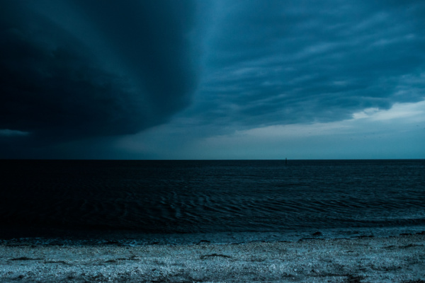
For a state that sees natural disasters regularly, the words “Florida” and “tsunami” rarely, if ever, go together within a sentence. According to Storm Advisor, there have been just eight tsunamis in Florida since 1848, with the most recent one being in 2001. But as USA Today reports, some residents of Clearwater Beach found themselves at the scene of a small one last week, and they might not even have realized it.
According to the Weather Channel’s Ari Salsalari, on Wednesday, June 21, Clearwater Beach experienced a meteotsunami. A “meteotsunami is a small, some would say, “tiny” tsunami, which the meteorologist explained is a strong squall line, also known as a line of thunderstorms, which collectively formed the phenomenon.
“Before the storms arrived, the wind was pretty light and out of the Southwest … and then sort of like a cold front, the winds switched out of the Northwest, so they kind of switched directions and they became pretty gusty right as the heavy rain arrived,” Salsalari said in a video posted to the Weather Channel site. “But here’s the thing, unlike a cold front, the pressure actually rose as the squalls made it to the shoreline.”
He showed that the pressure picked by around 2 p.m., adding that the rising pressure and changing direction of the wind caused water levels to jump by roughly two and a half feet.
What exactly is a meteotsunami?
The National Oceanic and Atmospheric Administration (NOAA) writes that meteotsunamis, unlike tsunamis triggered by seismic activity, are driven by air-pressure disturbances often associated with fast-moving weather events, such as severe thunderstorms, squalls, and other storm fronts. The storm generates a wave that moves toward the shore and is amplified by a shallow continental shelf and inlet, bay, or other coastal features.
These are still being studied and understood by scientists. So far, meteotsunamis have been observed to reach heights of over 6 feet and occur in many places around the world, including the Great Lakes, the Gulf of Mexico, the Atlantic Coast, and the Mediterranean and Adriatic Seas.
What is the difference between a meteotsunami and seiches?
NOAA shares that meteotsunamis and seiches will be confused for one another, as winds and atmospheric pressure can contribute to the formation of both.
However, winds are typically more important to a seiche motion, while pressure often plays a substantial role in meteotsunami formation. Seiches are standing waves with longer periods of water-level oscillations, typically exceeding periods of three or more hours. Meteotsunamis are progressive waves limited to the tsunami frequency band of wave periods anywhere from two minutes to two hours.
Is it likely for a tsunami to happen in Florida?
Even though weather experts say the Atlantic Ocean has a relatively low rate of tsunami occurrences, and that Florida very rarely experiences many tsunamis, it is still at risk. Now with climate change upending all the weather norms, who knows when the next meteotsunami or actual tsunami might happen?
—
Photo Credit: Dex Sightseeing Photography / Shutterstock.com