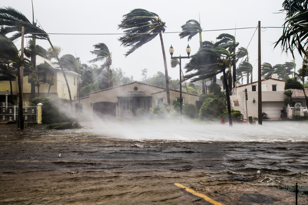
Just when the East Coast thought they’d made it through the 2026 Atlantic Hurricane Season relatively unscathed, suddenly there’s a subtropical storm a’brewin’.
Hurricane season officially runs through the end of the month, and while it has been a quiet year, there could be one more named storm, according to the National Hurricane Center (NHC). As of the NHC’s 1 p.m. tropical outlook Wednesday, the forecast calls for a nontropical low-pressure system to form near the northern Bahamas by late Friday.
“This system could become a subtropical or tropical storm while it moves northward or northeastward near or offshore of the southeastern U.S. coast through the weekend,” forecasters said. “Regardless of development, strong winds, dangerous surf, and coastal flooding are likely along portions of the Southeast and mid-Atlantic coasts into early next week.” The NHC gave is a 40% chance to develop in the next seven days.
More Rain and Flooding Expected for Florida and Southeast Coast
According to The Weather Channel, this East Coast storm could bring soaking rain, wind and coastal flooding to parts of the Southeast coast this weekend. Yes, adding even more rain and flooding to an already saturated Southeast coastline. Then, it could rake up the Northeast on Monday.
By Friday, expect low pressure to develop off Florida’s Atlantic coast. In the meantime, a stuck weather pattern will trigger more flooding rain in parts of Florida. That area of low pressure is then expected to track near or off the Southeast coast this weekend and gain some strength. That could bring rain, winds, coastal flooding and beach erosion to areas from the Georgia coast to the Carolinas and at least parts of Virginia.
The exact path the low takes is uncertain, and that will determine who picks up heavy rain and how far inland the wind threat spreads. For now, consider canceling any weekend beach plans along the Southeast coast, and stay out of the water as the threat of breaking waves and rip currents will be high.
The Northeast Could Get Hit Next Week
While rain could spread into parts of the mid-Atlantic Sunday, the forecast after that is uncertain. That’s because computer model tracks of this low-pressure system from late Sunday into Monday range from well offshore to a closer march up the East Coast from the Delmarva Peninsula to New England.
How close that low tracks will determine how much wind and rain occur and how far inland they extend. Strong winds capable of power outages and tree damage are possible from late Sunday into Monday near the Northeast coast. Regardless of the storm’s track, at least some coastal flooding at high tide, high surf, and rip currents are a good bet from the Virginia Tidewater to New England.
Travel advisory: If you have Thanksgiving week travel plans on Monday departing/arriving in the major Northeast hubs, weather-related flight delays are possible.
Subtropical Storm Kyle?
There’s a curveball with this offshore low that could sit over the Gulf Stream, a warm water current off the Southeast coast, which could help pop enough showers and thunderstorms near its center to morph it into something called a “subtropical storm.”
A subtropical storm is fueled by the clash between cold and warm air and the heat from the ocean. It is different from a tropical storm, hurricane, and even a nor’easter — and it can mean a lot of rain, wind, and rough seas for those living along the coast.
The NHC issues advisories, watches, and warnings for subtropical depressions and storms, just like they do for tropical storms. They are assigned a number or name, just like a tropical depression or storm. These subtropical storms can still bring heavy rain, gusty winds, and storm surge like a tropical system or hurricane.
Should this subtropical storm stay over warm water long enough, it can begin to transition to only using the warm ocean as its fuel source, fully becoming a tropical storm or even a hurricane. But even if it doesn’t become tropical, mature subtropical cyclones can have winds and rain some distance from the center, catching people inland off-guard.
The NHC has circled that area for possible development this weekend. Chances are growing. If the storm gains winds of at least 40 mph and enough thunderstorms near it, it could be named either Subtropical or Tropical Storm Kyle.
For the most part, the key is determining the track of the low, regardless of what meteorologists call it.
—
Photo Credit: FotoKina / Shutterstock.com
