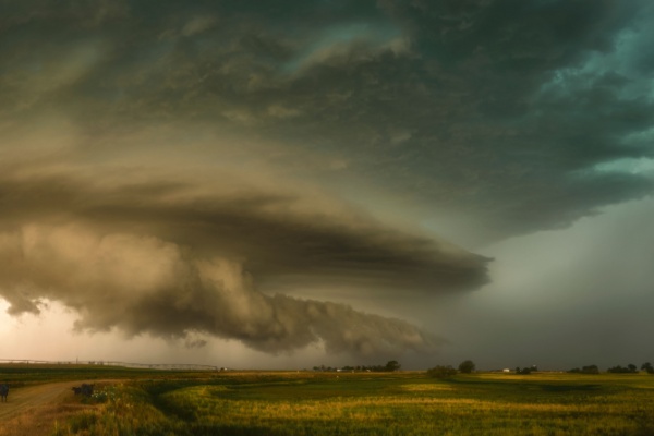
A significant surge of moisture from Mexico will unleash numerous showers and thunderstorms across the interior West into this weekend. Meanwhile, a separate storm will trigger mainly dry thunderstorms in parts of the Northwest.
What is a Monsoon, and What Causes It?
When people think of a monsoon, they often think of heavy rains that pour down for weeks. But according to the National Oceanic and Atmospheric Administration (NOAA), while a rainy season is part of a monsoon, a monsoon is more than just rain. In fact, monsoons can also cause dry weather. Monsoons are caused by a change in the direction of the wind that happens when the seasons change. In fact, even the word monsoon comes from the Arabic word mausim, which means “season.”
A monsoon is caused by a seasonal shift in the winds. The winds shift because the temperature of the land and the temperature of the water are different as seasons change. For example, at the beginning of summer, the land warms up faster than bodies of water. Monsoon winds always blow from cold to warm. In the summer, warm air rising off the land creates conditions that reverse the direction of the wind.
When and Where do North American Monsoons Happen?
The North American Monsoon is a seasonal change in wind that occurs as the summer sun heats the land of North America. During much of the year, the strongest winds over northwestern Mexico, Arizona and New Mexico are dry air blowing from the west. But as the land heats up in the summer, the wind begins to change direction and blows from the south. This new wind blows moist air from the Pacific Ocean and Gulf of California into the region, resulting in thunderstorms and rainfall.
In general, the North American Monsoon begins each year in Mexico in June. The winds blowing from the south move the monsoon to the U.S. Southwest in July. By mid-September, winds are once again blowing from the west, marking the end of the monsoon.
This seasonal weather pattern is characterized by a shift in wind patterns to southerly winds that bring moisture from the Pacific Ocean and the Gulf of Mexico, resulting in increased rainfall and thunderstorms, particularly in Arizona, New Mexico, and parts of California and Texas. It’s been active at times this summer, but its rainfall has also been sporadic and miserly, leaving large portions of the Colorado River Basin dry as a bone.
Things are About to Change
That is, until now. As AccuWeather reports, over the course of this week, at least across part of the basin, a plume of deep moisture is going to stream northward from Mexico. Most of the downpours will be concentrated across New Mexico and Colorado, where 1-2 inches of rain is expected, with locally higher amounts. Showers and thunderstorms will also extend westward across Arizona and Utah, producing anywhere from a few hundredths of an inch of rain to around 2 inches in the wettest locations. Most desert areas of Nevada and California are still forecast to miss the rain.
Flash flooding may occur under the most intense storms and in areas repeatedly hit by downpours. Hikers and campers should avoid canyons, arroyos and small streams because storms miles upstream can send sudden surges of water downstream. Away from the plume of moisture streaming out of Mexico, a relatively dry storm will move across parts of Oregon, Northern California and northern Idaho through Thursday.
Atmospheric Instability Will Produce Thunderstorms, Flooding
This storm will bring cold air higher in the atmosphere while temperatures near the ground remain warm. The resulting atmospheric instability will produce thunderstorms with little rain, gusty winds and small hail. Lightning from these mainly dry thunderstorms could ignite new wildfires.
Much of the region from the Rockies to the Pacific Coast could benefit from soaking rain that does not cause flooding. Drought conditions are especially severe across the Colorado River Basin, with vast areas experiencing severe to exceptional drought.
Low flows on the Colorado River have contributed to historically low water levels in Lake Powell and Lake Mead. Both reservoirs support hydroelectric power generation at their respective dams. Lake Powell is now at only 22% of capacity, while Lake Mead is at 27%. A push of dry air from the Pacific is forecast to sweep from west to east over much of the region this weekend.
“The current influx of moisture from the North American monsoon may produce one of the last major surges of showers and thunderstorms this year,” AccuWeather Senior Meteorologist Dave Houk said. “However, some additional pulses are likely in the coming weeks. The tropics remain a wild card, especially if a storm moves northward along Mexico’s west coast.”
One such surge of tropical moisture is forecast to emerge from the Gulf of California, across northwest Mexico and then into the United States later this week. If this organizes into a tropical depression or storm prior to landfall, it could bring locally heavy to excessive rainfall to parts of Arizona from Wednesday night to Thursday.
—
Photo Credit: Wirestock Creators / Shutterstock.com
