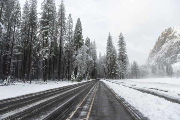
Snow shovels, winter coats and heating systems will be put to work in the coming months, but the upcoming winter season could look very different across the United States compared with recent years.
As AccuWeather reports, a potentially record-shattering El Niño is expected to be the dominant force shaping the 2026-2027 winter, influencing where storms track, where snow piles up, and which areas experience more warm spells than Arctic blasts. Just as El Niño flip-flopped the normal Hurricane activity seen in the Pacific and Atlantic, so too will winter weather feel like it’s upside down.
How cold will it get, and how much snow will fall? AccuWeather’s winter forecast breaks down what to expect across the country.
How will El Niño shape winter 2026-2027?
“This has the potential to be the strongest El Niño on record,” AccuWeather Long-Range Expert Paul Pastelok said, almost certain to surpass the powerful El Niño events of 1982-83 and 1997-98.
The effects of El Niño across North America are amplified during the winter months. Typically, it strengthens the southern storm track, favoring more precipitation from California through the Gulf Coast. Farther north, warmer-than-average conditions are common, with fewer intrusions of Arctic air.
The El Niño-fueled pattern can fluctuate throughout the season as other factors come into play. These influences can temporarily reshape storm tracks and lead to shifts in snowfall and temperatures, including occasional cold snaps in areas otherwise predicted to have a warmer winter.
How much snow will fall this winter?
The 2026-27 winter snow forecast is almost the opposite of what unfolded last winter across the country, with some of the heaviest snow expected in areas that largely missed out on snowstorms last year. The snow season is expected to get off to an early start from the Sierra Nevada through the Great Basin and into the central and southern Rockies, a boon for ski resorts following a poor season last winter.
A shift in the storm track will also bring opportunities for snow across the Plains in January and February, making up for infrequent snowfall during the first part of winter. “The primary storm track, particularly in the first part of winter, will be across the southern U.S. and leave many areas in the Plains void of snow,” AccuWeather Senior Meteorologist Chad Merrill said. This storm track will also lead to opportunities for snowflakes across the Southeast and into the southern Appalachians.
Meanwhile, much of the Northeast, Midwest and Northwest is forecast to receive less snow than average. The southern Appalachians and northern New England have a better chance of finishing near or above average. Changes in the West Coast storm track can also bring occasional storms into the Pacific Northwest and northern Rockies. Below-average seasonal snowfall does not rule out a major snowstorm in the East. The Northeast could still experience a significant storm during the middle or latter part of winter, which could boost seasonal snowfall totals.
Snowfall totals are forecast to be less than half of what was measured last winter in major cities across the Northeast. Philadelphia, which measured 30.1 inches last winter, is forecast to receive 5-15 inches this winter. Boston recorded 62.8 inches last winter but is forecast to receive only 15-30 inches. Lake-effect snow may also be less frequent around the Great Lakes early in winter because of the lack of Arctic outbreaks. Some lake-effect events remain possible later, especially if the lakes remain largely ice-free into January and February.
Atmospheric Rivers could bring Flooding to the Western Coastlines and Snow to the Mountains
The West may experience some of the most consequential weather of the winter as a parade of storms, including atmospheric rivers, moves in from the Pacific Ocean. “The southern storm track is generally stronger, more active and can produce flooding rain, landslides and heavy mountain snow for parts of the nation,” Merrill said.
Several atmospheric rivers are expected, especially in California. The storm focus may begin across Central and Northern California before shifting farther south into the Los Angeles and San Diego areas as winter progresses. Individual storms could unload feet of snow in the mountains while bringing flooding to lower elevations, along with landslides, high winds, coastal flooding and beach erosion.
The wet pattern could also bring much-needed precipitation after an exceptionally poor 2025-2026 snow season across much of the Southwest and Rocky Mountains. The Bureau of Reclamation said the Colorado River Basin experienced record-low snowpack last winter, and combined water storage in Lake Powell and Lake Mead fell below levels seen since before Lake Powell began filling in 1963.
Frequent storms are forecast to bring heavier snow than last winter across the interior West, including the Sierra Nevada and central and southern Rockies. By February, the Four Corners region is expected to trend cooler than average with above-average precipitation, helping support additional mountain snow. But even a stormy winter would not erase the region’s long-term water concerns, with several wet and snowy winters needed to replenish major reservoirs depleted over years of drought.
The Northwest may see a less consistent pattern, with periods of snow interrupted by extended stretches of dry weather as the main Pacific storm track frequently focuses farther south. Salt Lake City measured only 3.7 inches of snow last winter, its least snowy season since records began in the 1880s. AccuWeather is forecasting a dramatic turnaround, with 50-65 inches of snow this winter, slightly above the historical average.
Which areas will have the coldest winter?
December is expected to start on a warm note across the Upper Midwest and Great Lakes, limiting opportunities for lake-effect snow. Shots of colder air may still dive south from Canada as the season progresses, but average temperatures throughout the winter season are predicted to run above normal.
Some of the more persistent colder-than-average conditions are forecast across the Four Corners region and parts of the south-central Plains, with cooler periods occasionally reaching the Gulf Coast. Storms, rain and widespread cloud cover across this region will help hold temperatures down, while also raising the risk of dangerous weather.
Repeated rain could have longer-term impacts on rivers across the Tennessee and lower Mississippi valleys. Areas entering winter with low river levels could experience above- or well-above-flood-stage conditions by spring if the active storm pattern unfolds as forecast.
Why this El Niño may be different than the Strongest in History
El Niño develops when water temperatures around the equator of the eastern Pacific Ocean become at least 0.9 F (0.5 C) warmer than average. That ocean warming triggers changes in the atmosphere thousands of miles away, reshaping storm tracks across North America. The warmer the water, the greater its influence on global weather patterns.
The ongoing El Niño has far exceeded this threshold, with water temperatures expected to peak higher than during the powerful El Niño events of 1982-83, 1997-98 and 2015-16. “Not all El Niño winter seasons behave the same,” Pastelok said.
One factor that could alter the typical pattern is unusually warm Pacific water stretching from southeast of Hawaii toward Baja California and Southern California. That warmth could alter the path Pacific storms take before reaching the United States. A similar setup during the winter of 2015-16 resulted in a drier winter than typically expected during a strong El Niño across California, while more precipitation focused farther north.
Another piece to watch will be how frequently storms track through the central Plains. That pattern is expected to become more evident during the middle and latter parts of winter, and its frequency could determine whether some parts of the Plains and Midwest make up early-season snowfall deficits.
Meteorologists are also monitoring water temperatures in Baffin Bay, located to the west of Greenland. If little sea ice forms in this region during the winter, it could create an atmospheric ripple effect that opens the door for bigger storms along the East Coast.
Meteorological winter officially begins on Tuesday, Dec. 1.
—
Photo Credit: Kyungjun Kim / Shutterstock.com
