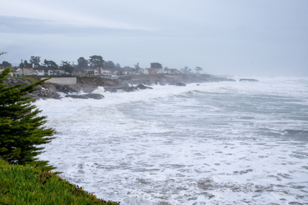
AccuWeather forecasters say that the latest California storm fell just short of being considered an atmospheric river, but it was still a force to be reckoned with. As the center of the system strengthened on its final approach to the California coast, it underwent a meteorological process known as bombogenesis, otherwise known as a “bomb cyclone.”
In most instances, a bomb cyclone is when the central pressure of the storm plummets by 0.71 of an inch of mercury (24 millibars) in 24 hours. However, the National Weather Service (NWS) says that the benchmark is different depending on the latitude of the storm.
For the zone just south of the Bay Area, the central pressure of a storm only needs to drop 0.47 of an inch of mercury (16 mb) over a 24-hour period to be considered a bomb cyclone. This adjusted benchmark was achieved late Monday through Tuesday afternoon as the center of the storm rapidly intensified from 29.68 inches of mercury (1005 mb) to 29.08 inches of mercury (984 mb).
At least five fatalities are being blamed on the storm, with at least three due to powerful winds blowing trees over and landing on occupied vehicles, according to The Associated Press (AP). Two of the deaths occurred in the town of Portola Valley, located in the Bay Area, in Rossmoor, about 7 miles east of Long Beach in Southern California.
One man inside a tent died Tuesday night near Lake Merritt in Oakland, after a tree fell onto the tent. Two others died at Zuckerberg San Francisco General Hospital while receiving treatment for injuries, according to city officials, in separate storm-related incidents.
A San Francisco police sergeant was hospitalized Tuesday with life-threatening injuries after a tree struck the car he was driving during the afternoon, with firefighters responding to the scene and removing the sergeant from the vehicle. His updated condition is not known as of Wednesday afternoon.
According to AccuWeather, downed trees also contributed to nearly 250,000 power outages across the state on Tuesday afternoon, many of which were located in and south of the Bay Area. The number of households and businesses without service was halved by Wednesday afternoon, according to PowerOutage.us, although some of the outages were expected to linger for several days in the hardest-hit areas of California.
“The impacts from the event resembled that of a landfalling strong tropical storm – likely the closest San Francisco residents will ever come to experiencing that meteorological phenomenon,” AccuWeather Director of Forecast Operations Dan DePodwin said.
“Tropical storm-force wind gusts (39-73 mph) were reported for seven consecutive hours in Oakland,” he added. “Despite being vastly different in structure than a tropical system, the compact area of low pressure on radar resembled the eye of a hurricane as it moved onshore Tuesday afternoon just south of San Francisco.”
As Californians begin to clean up in the wake of the bomb cyclone, they will also begin to once again prepare for another round of snow, wind and rain.
“There will be no rest for the weary in California next week,” said AccuWeather Senior Meteorologist Heather Zehr. “Fortunately, the overall strength and amount of moisture in the next storm will be lower, and it seems Southern California, which was one of the hardest hit areas from the last storm, might be largely spared from the heaviest precipitation.”
—
Photo Credit: Rosangela Perry / Shutterstock.com
