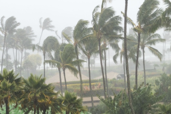
The third storm in less than a month is bringing more downpours to Hawaii, and as AccuWeather reports, the added rainfall is expected to renew dangerous flooding and mudslides into next week.
“The wet weather is being produced by a developing Kona storm approaching from the west,” said AccuWeather Senior Meteorologist Brett Anderson. “The storm is increasing the flow of tropical moisture across the islands on southerly winds.”
Kona Lows and Storms
Kona means “leeward” in Hawaiian, as these storms bring downpours to areas typically sheltered by persistent northeast trade winds. A Kona storm (or Kona low) is a slow-moving, cold-core cyclone that affects Hawaii between October and May, bringing heavy rain, high winds, and severe weather to typically dry leeward areas. Unlike trade winds, they bring winds from the southwest (“kona” side), often causing flooding, landslides, and high surf.
When the trades are active, rain is usually focused on the northeastern slopes, leaving southwestern areas mostly dry. The islands’ mountainous terrain enhances both rainfall and rain shadow effects. Downpours since Tuesday have already brought an inch or more of rain to Honolulu and up to a foot of rain across the southern parts of the Big Island.
Rounds of drenching downpours and gusty thunderstorms will continue into Friday night, local time. “The most concentrated rainfall is likely from Thursday night to Friday evening, when excessive rainfall rates will be most common,” Anderson said. In some cases, rainfall may exceed an inch per hour on south- and west-facing mountain slopes.
Infrastructure Issues Add to Resident’s Woes
High water is likely on poorly drained city streets. In hilly terrain, some roads may turn into fast-moving streams. Reservoirs may fill to capacity and overflow, increasing the risk of levee issues. “A lull in the downpours is possible on Saturday, but additional showers and thunderstorms are likely into early next week as a front associated with the Kona storm stalls over the region,” Anderson said.
Kona snow for the summits
Over the highest volcanic summits on the Big Island, heavy snow will fall at times, along with some ice accumulation. Whiteout conditions are possible. These summits rise above 13,000 feet, where snow is not uncommon during colder winter storms, such as Kona lows.
Rough seas and severe thunderstorms
Gusty winds from the stormy pattern will stir heavy surf along the shorelines of the islands that rarely experience large waves. The stormy seas will create hazards for small craft and swimmers. Some effects of the Kona storm may include producing a couple of tornadoes or waterspouts, which are rare around Hawaii.
Staggering rainfall totals from the 3 Kona storms
“During the prior two Kona storms in March, Maui received the most rainfall, according to reports,” said AccuWeather Meteorologist and Social Media Producer Jesse Ferrell. “Between 15 and 30 inches fell on coastal flatlands, with a whopping 50 to 72 inches in the mountains.”
It is conceivable that some locations over the mountains may receive 100 inches of rain or more during the approximate four-week period ending around the middle of April. Rainfall in Honolulu could approach or exceed 20 inches for the same period, compared to a historical average near 3 inches, or six to seven times that of normal.
—
Photo Credit: Ryan DeBerardinis / Shutterstock.com