Just about every small town and major city has some sort of New Year’s Eve celebration, whether it is an officially scheduled event or just a friends and family gathering to ring in 2025. This year’s New Year’s forecast looks to be a good news/bad news situation.
The good news is that the weather will be dry and cooperative across much of the United States as the last minutes of 2024 wind down and the first moments of 2025 begin.
Now for the bad news. AccuWeather meteorologists caution that there will be some trouble spots for NYE, and most of the trouble will be in popular places where millions of people gather. Case in point: there’s a trouble-making setup for the Northeast from Tuesday to Wednesday of this week. That brewing storm will likely bring drenching rain from North Carolina to Virginia, West Virginia, Ohio, Delaware, Maryland, New Jersey, much of Pennsylvania, southeastern New York and southern New England.
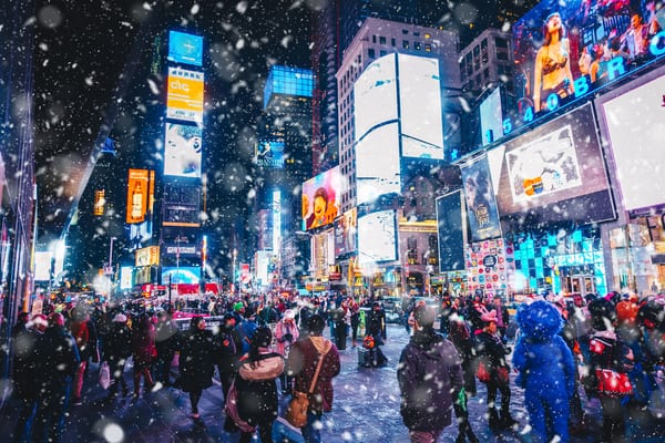
And yes that means that New York City, namely Times Square, will be one of the areas that soaked by the storm. People heading to the event should be prepared for the rain to move in and pour down for the second half of the evening hours on Tuesday, lasting through when the ball drops at midnight and on into the early morning on Wednesday. Plastic rain slickers and waterproof shoes will help make the wait more comfortable. While it will not be all that cold, the combination of a breeze, rain and dampness may keep AccuWeather RealFeel® Temperatures near 40 F.
Rain is not the only form of precipitation the storm will likely bring. Snow may fall around the northern and western Great Lakes, including Chicago. At the very least, a wintry mix will occur on the northwestern flank of the storm from parts of Indiana to northern and western New York state and northern New England. How extensive the wintry mix and snow area ends up in the Northeast and the Midwest will depend on the speed, intensity and track of the storm.
Another trouble spot will be part of the Pacific coast that has been contending with frequent storms this month. On-and-off rain is likely to pester revelers in Portland, Oregon, and Seattle on New Year’s Eve. Actual temperatures for outdoor activities will be in the mid-40s, with AccuWeather RealFeel® Temperatures likely to be in the 30s. At this time, it appears any rain will stay to the north of San Francisco.
For those celebrating the new year on the ski slopes in the Rockies, snow showers will dot areas from Montana and Wyoming to parts of Colorado on New Year’s Eve. Any measurable snow will likely avoid Denver.
Mostly clear conditions are in store for downtown Los Angeles Tuesday night, with temperatures falling into the 50s. But while rain will not be of any concern in Southern California, a Santa Ana may kick up from Tuesday to Tuesday night. Even though the wind event may not be too strong, it will increase the wildfire danger. As a result, the use of open flames for cooking and construction, and fireworks for celebration activities is not recommended.
Following spotty evening showers, Orlando, Florida should be dry at midnight, with temperatures in the upper 60s to near 70. And dry conditions are in store for much of the remainder of the Lower 48 states from Tuesday to Wednesday. Temperatures will moderate after a cool start in the Southwest while cooler air spreads from the Midwest to the Southeast states.
—
Photo Credit: Clari Massimilliano / Shutterstock.com
