It looks like this year’s Atlantic Hurricane System, which had a historically late start, with zero hurricanes throughout the month of August, is trying to make up for lost time in September.
As AccuWeather reports, Floridians have rushed to evacuate ahead of Hurricane Ian as the Category 3 storm, packing maximum sustained winds of 120 mph, emerged over the eastern Gulf of Mexico. Rapid intensification resumed after the storm pounded the western tip of Cuba with fierce winds and life-threatening storm surge, becoming the strongest storm to make landfall there since Category 5 Hurricane Irma in 2017.
The major hurricane, which is set to strengthen further and reach Category 4 force later Tuesday or early Wednesday over the bath-warm waters of the eastern Gulf of Mexico, will make landfall along the west coast of Florida Wednesday evening, putting places from Tampa to Fort Myers at risk for extremely dangerous storm surge among other hazards.
AccuWeather forecasters have rated Ian a 3 on the AccuWeather RealImpact™ Scale for Hurricanes for the United States due to the dangers, which will include flooding rainfall and damaging winds even for areas well inland from where the Ian crashes onshore around midnight Thursday.
Jamie Rhome, the acting director of the National Hurricane Center, said in an interview with CNN that Tuesday was the last day for people to safely flee ahead of the monster storm, and Lee County, which issued mandatory evacuation orders Tuesday morning had opened public shelters. Those who remain behind will need to hunker down, prepared to ride out a major hurricane hit — one that he said one day earlier on CNN will be “the storm of a lifetime for many Tampa Bay residents.
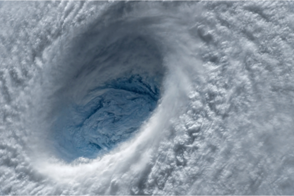
Ian was swirling about 20 miles south-southwest of the Dry Tortugas as of 8 p.m. EDT Tuesday and was moving northward at 10 mph. Hurricane-force winds extended outward 40 miles and winds of tropical storm force reached 140 miles from the center, according to the National Hurricane Center (NHC).
Hurricane warnings were in effect along the Florida west coast to Chokoloskee to Anclote River, including Tampa Bay, as well as the Dry Tortugas. A tropical storm warning was in effect from Anclote River to the Suwannee River and from Flamingo to Chokoloskee, all of the Florida Keys, Lake Okeechobee and from Flamingo to Altamaha Sound.
After exploding into a Category 4 storm, Ian will lose some wind intensity due to disruptive wind shear before it turns to the northeast and makes landfall along the west-central coast of Florida late Wednesday to Wednesday night. AccuWeather forecasters warn that the full force of a major hurricane should be expected as Ian slams into central Florida.
As steering breezes ease at midweek, there is the potential for the storm to slow down as it nears the Florida coast and drifts inland, which can exacerbate dangers by increasing the duration of flooding rain, high winds and coastal inundation.
The effects of the large hurricane will be far-reaching across the Florida Peninsula with damaging wind gusts and power outages possible throughout. The greatest risk to lives and property will be due to storm surge and coastal inundation.
Ian has been designated a 3 on the AccuWeather RealImpact™ Scale for Hurricanes in the United States, meaning AccuWeather forecasters believe the storm poses a high risk to life and property across a significant portion of Florida due to the persistent threat of storm surge along the Gulf coast of Florida in addition to widespread damaging winds and flooding rainfall. “The worst conditions in terms of storm surge will depend on exactly where the center of the storm moves inland along the Gulf coast,” AccuWeather Hurricane Expert Dan Kottlowski said.
“Should the center of the storm move in well south of St. Petersburg, as we believe now, then communities around Tampa Bay would be spared the worse water rise. In this case, however, a serious water level rise could inundate areas farther south, perhaps from Venice to Port Charlotte and Cape Coral,” Kottlowski explained. Communities around Charlotte Harbor could experience a water level rise of 6-10 feet with locally higher inundation. This encompasses much of the same area that was hit so hard by Hurricane Charley in 2004.
A water level rise of 6 to 10 feet, which can occur anywhere just south of where the eye makes landfall, is expected to have catastrophic consequences.
Even if the center of Ian tracks in south of St. Petersburg, torrential rain and storm surge will still lead to significant coastal and inland flooding in the Tampa Bay area. At this time, AccuWeather meteorologists anticipate a water level rise of 3-6 feet in Tampa Bay communities. Both of these conditions are a concern for areas in Florida as far away as Jacksonville, which is about 200 miles Northeast of Tampa along the state’s northern Atlantic coast.
“Easterly winds will push Atlantic Ocean water toward the Florida east coast,” Kottlowski said. “The combination of easterly winds and torrential rainfall can lead to a double-whammy effect with significant flooding along the St. Johns River in the Jacksonville area.” A water level rise of 3-6 feet is likely along the lower portion of the St. Johns River with storm surge of 1-3 feet anticipated along much of the Florida east coast.
While the storm’s overall highest wind gusts were likely to occur over western Cuba, gusts reaching 120 to 140 mph will blast the west-central portion of the Florida Peninsula. An AccuWeather Local StormMax™ wind gust of 150 mph is possible near and just to the northeast of the point of landfall.
Torrential rain will be the most frequent near and north of the storm track with a general 8-16 inches and an AccuWeather Local StormMax™ rainfall of 30 inches forecast. Even though the soil is sandy and porous over much of Florida, rainfall of this magnitude will lead to widespread flooding in central and northern Florida.
Major urban flooding is likely around Tampa, Orlando, Ocala and The Villages. However, localized incidents of flooding rain can occur farther south over the Florida Peninsula, including in places like Melbourne, Miami and West Palm Beach, as well as the Florida Keys due to spiral bands.
Severe thunderstorms, some with the potential to spawn brief tornadoes, will add to the danger and risk of power outages and property damage more than 100 miles from where the center of Ian makes landfall. Waterspouts will pose dangers to coastal areas, and some of these may come ashore as tornadoes.
AccuWeather forecasters began alerting the public of the potential for a hurricane to threaten Florida early last week in order to give people time to take the necessary precautions to save lives and protect property. With Ian continuing to strengthen, the entire AccuWeather team is urging those in the path of the storm to stay vigilant and heed the advice and orders of local officials.
AccuWeather meteorologists predict that the risk to lives and property from the effects of Ian will extend well beyond Florida. Slow forward motion of the storm could have serious consequences for other states such as Georgia, the Carolinas, Virginia, West Virginia and the eastern parts of Tennessee and Kentucky.
There is the potential for Ian to move over the Atlantic Ocean for a brief time after crossing the Florida Peninsula. Ian may drift off the coast of northeastern Florida on Friday, before turning back toward the U.S. coast this weekend.
The latest indications are that Ian, as a tropical storm, depression or rainstorm, will wander slowly northwestward over the Southeastern states through the weekend and threaten the likelihood of torrential rainfall and flooding. Near the Georgia and Carolina coast, there is also the potential for inundation due to both storm surge and heavy rainfall.
—
Photo Credit: Evgeniyqw / Shutterstock.com
