After a multiday risk of severe thunderstorms sprang to life across the central United States much of last week, responsible for the deaths of at least 8 people in the region, AccuWeather meteorologists warn that more severe weather is on the way toward the middle of this week across the Plains and Ohio Valley.
A potent storm that will track across the Plains and Great Lakes into midweek will interact with clashing warm, Gulf air and cooler Pacific and Canadian air with plenty of moisture in place. This will set the stage for severe thunderstorms from Texas to the Ohio Valley on Tuesday and Wednesday. “This could be the largest outbreak of severe weather so far this year,” said AccuWeather Senior Meteorologist Adam Douty.
People are Urged to Have a Plan
Individuals are urged to have multiple ways to receive warnings and to have a plan, as severe thunderstorms could continue into the night, including the potential for nocturnal tornadoes. Having a pair of closed-toe shoes, a flashlight and charged electronic devices nearby before going to sleep each night are some ways to be prepared ahead of the severe thunderstorm risk.
The risk for flash flooding will also accompany the severe thunderstorm risk across much of the Plains and Ohio Valley after numerous rounds of storms during the first week of March saturated the ground. Levels on some rivers and streams in the region could also rise as a result of the stormy stretch.
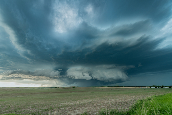
Risk for Thunderstorms Monday ahead of possible outbreak
Thunderstorms are expected across portions of Texas into Alabama and western Tennessee on Monday and Monday night. While these thunderstorms are not expected to reach the same magnitude that is expected to occur on Tuesday and Wednesday, there is a corridor from Arkansas to Alabama where storms could turn severe.
Hazards, including hail, downpours and localized damaging wind gusts up to 60 miles per hour, could accompany any severe thunderstorm that develops. The AccuWeather Local StormMax™ is 75 mph.
Severe Storms to Ramp Up Tuesday
The risk for severe thunderstorms will blossom Tuesday afternoon into Tuesday night across a large swath of the central U.S. from Texas to southwestern Michigan. Metro areas, including Dallas, St. Louis, Oklahoma City and Indianapolis, could all be impacted by severe thunderstorms.
Hazards, including hail, flash flooding and damaging wind gusts up to 70 mph, are expected with any severe thunderstorm. There will also be the risk for isolated tornadoes as well. “The greatest tornado risk Tuesday afternoon and Tuesday night is expected to develop from Missouri to Indiana,” said Douty.
Residents, especially in this zone but also across the entire area at risk for severe weather, should identify the safest place to shelter at home, work or school in the event a tornado occurs.
Severe Threat Shifts East on Wednesday
As the storm tracks east into the Great Lakes, so will the risk for severe thunderstorms. The threat will stretch across over a dozen states on Wednesday and Wednesday night from eastern Texas to western Pennsylvania.
Hail, damaging wind gusts of 60-70 mph and isolated tornadoes could accompany any severe thunderstorm. Those traveling to and from any airports in the region, as well as on roadways including portions of interstates 10, 20, 40, 64 and 70, should prepare for potential delays.
—
Photo Credit: Joe Belanger / Shutterstock.com