As Hurricane Melissa slowly churns across the warm waters of the Western Atlantic over the upcoming days, AccuWeather reports that hurricane experts continue to sound the alarm bells that a very dangerous and deadly situation is unfolding across the Caribbean.
Melissa has Already Turned Deadly in Haiti, Dominican Republic
As of Saturday afternoon, at least four fatalities had already been attributed to Melissa across Haiti and the Dominican Republic. With additional rain, wind and storm surge expected to be unleashed across the Caribbean as the storm gains strength, conditions are likely to rapidly deteriorate more in the coming days.
Into early week, this storm is forecast to gradually track in a general northwest fashion across a portion of the Western Caribbean. By late Monday, Melissa’s track will be influenced by the larger-scale pattern of the jet stream, allowing it to curve northward and shoot northeastward as the week goes on, making multiple landfalls as it travels across the northern Caribbean.
Melissa strengthened to a Category 4 hurricane (maximum sustained winds of 130-156 mph) early Sunday morning prior to it’s approach along the southern coastline of Jamaica. Melissa is expected to reach Category 5 designation (maximum sustained winds of 157 mph or greater) early this week.
What rapid intensification will mean for Jamaica
As Melissa gradually treks northward toward Jamaica, it will cross over some of the warmest waters in all of the Western Atlantic, which will help to fuel further intensification of the storm. Between the elevated sea surface temperatures surrounding Jamaica and a decrease in wind shear ahead of the storm (strong winds at various levels of the atmosphere that can cause storm disorganization and negatively impact intensity), it is a combination for intense strengthening.
Melissa is first expected to make landfall at about 9 a.m. Tuesday, Oct. 28, EDT, along the southern shore of Jamaica, less than 40 miles west of Kingston. “Much of Kingston’s critical infrastructure is located in low-lying areas that are vulnerable to storm surge. A key power plant, airport, shipping port, fuel terminal and water treatment plant all sit near the southern coast. A storm surge of 6-10 feet could seriously damage or destroy this infrastructure, worsening immediate impacts and complicating recovery efforts,” stated AccuWeather Chief Meteorologist Jon Porter. Near where the storm makes landfall in Jamaica, a storm surge of 10-15 feet can occur.
Porter added that, “Airports will play a key role in disaster relief operations, given the international response that will likely be needed to deliver emergency supplies and assistance.” Norman Manley International Airport, located in Kingston Harbor on the southeastern coast of Jamaica, is connected to the island by a narrow stretch of highway. This roadway is facing a rather high risk for damage given the current landfall location and projected intensification of the storm in the coming days.
Melissa to carve a path through the northern Caribbean
Across the western Caribbean, the AccuWeather RealImpact™ Scale for Hurricanes is 5, the maximum value possible. This scale, developed by AccuWeather experts, takes into account the risk to lives, property and economic impacts from the storm, including flooding, rain, storm surge and high winds. The Saffir-Simpson Scale for Hurricanes only takes into account a storm’s maximum winds.
The current track of Melissa will also mean a second landfall in eastern Cuba leading up to midweek. Cities and communities along the southeastern tip of Cuba are urged to complete preparations as soon as possible as Melissa approaches with wind, rain and a dangerous storm surge along the coast. Rainfall totals are projected to range between 12-18 inches across this corridor of Cuba, which can result in devastating damage to infrastructure, road washouts and mudslides across the varied terrain.
The intense and widespread rainfall will continue across the region for several days as the storm’s position comes to a crawl in the western Caribbean. Duffus added that the prolonged nature of impacts can result in entire communities being cut off from aid and support for multiple days.
Beyond the Caribbean: Where will Melissa go Next?
Melissa is expected to remain a powerful hurricane as it tracks through parts of the Bahamas this week. By this point, however, it should pick up some forward speed and be pulled out of the Caribbean and into the open waters of the Atlantic. Although, later on down the road, Melissa is expected to come close enough to Bermuda to bring impacts as well.
“The timing and strength of a dip in the jet stream over the eastern United States this week will help determine the path that Melissa takes through the northern Caribbean and into the southwestern Atlantic,” DaSilva said. “At this time, the odds of ‘direct’ rain and wind impacts from Melissa reaching the U.S. East Coast are low.” Farther out, there is a moderate risk of Melissa hooking westward toward Atlantic Canada.
Once Melissa exits the Caribbean, the closer it could eventually move toward the East Coast of the U.S. and notable indirect impacts are anticipated with assistance of the jet stream and a non-tropical storm between the last days of October to the first days of November.
—
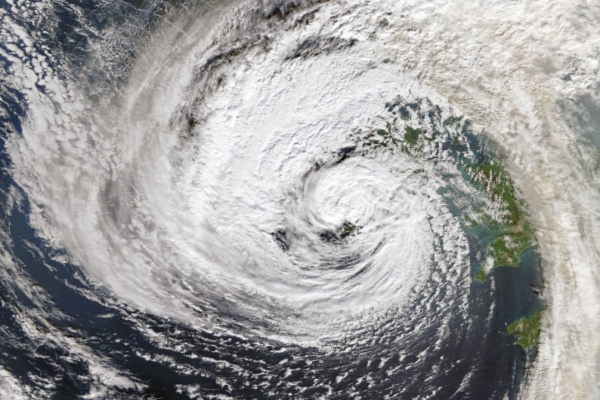
Photo Credit: NASA images / Shutterstock.com