A very powerful earthquake off Russia’s Far Eastern Kamchatka coast on July 30 triggered tsunami warnings as far away as French Polynesia and Chile, and was followed by an eruption of the most active volcano on the peninsula.
The magnitude 8.8 earthquake off the coast of Russia is one of the strongest earthquakes ever recorded, specifically ranking as the sixth strongest in history. It’s tied with the 1965 Rat Islands earthquake and is the largest since the 2011 Tōhoku earthquake in Japan.
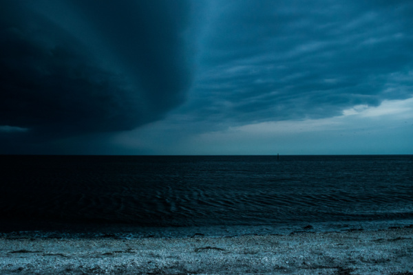
Widespread Damage and Volcano Eruption in Eastern Russia
As Reuters reports, the shallow quake damaged buildings and injured several people in the remote Russian region.
Russian scientists said the quake in Kamchatka was the most powerful to hit the region since 1952. “It felt like the walls could collapse any moment. The shaking lasted continuously for at least three minutes,” said Yaroslav, 25, in the city of Petropavlovsk-Kamchatsky.
Kremlin spokesman Dmitry Peskov said there had been no casualties in Russia from the quake, crediting solid building construction and the smooth working of alert systems. In Severo-Kurilsk in the northern Kuril Islands, south of Kamchatka, tsunami waves exceeded 9.8 feet (3 meters), with the largest up to 16 feet (5 meters), Russia’s RIA news agency reported.
Tsunami waves partially flooded the port and a fish processing plant in the town, sweeping vessels from their moorings, regional officials and Russia’s emergency ministry said. Verified drone footage showed the town’s entire shoreline was submerged, with taller buildings and some storage facilities surrounded by water.
The Klyuchevskoy volcano on Russia’s Kamchatka Peninsula began erupting later, a geological monitoring service said. “A descent of burning hot lava is observed on the western slope. Powerful glow above the volcano, explosions,” the Russian Academy of Sciences’ United Geophysical Service said in a statement posted on Telegram.
Strong Waves in Pacific Region, but Less than Feared
Tsunami alarms sounded in coastal towns across Japan’s Pacific coast and evacuation orders were issued for tens of thousands of people. Workers evacuated the stricken Fukushima nuclear plant, where a meltdown following the 9.0 magnitude earthquake and ensuing tsunami in 2011 caused a radioactive disaster, operator TEPCO said.
But Chief Cabinet Secretary Yoshimasa Hayashi said no injuries or damage had been reported, and there were no irregularities at any nuclear plants.
Parts of Hawaii were also under sudden emergency evacuation orders, causing traffic jams and a period of mass panic as people fled the densely populated area of Waikiki, Oahu for higher ground.
By the evening, Russia, Japan and Hawaii had downgraded most of their tsunami warnings. Hawaii recorded waves of up to 5 feet (1.7 meters) while in Japan the largest recorded came to just over 4 feet (1.3 meters), officials said. Flights out of Honolulu airport resumed in the evening, the transportation department said.
Authorities in French Polynesia initially warned residents of several of the remote Marquesas Islands to move to higher ground and expect waves as high as 8 feet (2.5 meters), and waves started to hit some islands in the early morning hours of Wednesday. While the Marquesas are high-rising volcanic islands, much of French Polynesia consists of low-lying atolls.
In other parts, wave heights were expected to remain below 12 inches (30 cm), not requiring evacuation or sheltering. “Our armed forces in French Polynesia are on alert as a precautionary measure, to be ready to assist our fellow citizens and state services in potential search and rescue operations or medical evacuations,” French Defence Minister Sebastien Lecornu said on the social media platform X.
Waves of nearly half a meter were observed as far away as California, with smaller ones reaching Canada’s province of British Columbia.
On Wednesday, The NOAA canceled the tsunami advisory for some coastal areas of California from the California/Mexico border to Rincon Point, California, located 15 miles southeast of Santa Barbara, meaning the Los Angeles area was no longer under a tsunami advisory.
However, in the northern California and southern Oregon region, a tsunami advisory remained in effect from Rincon Point north to the Humboldt/Del Norte line and up to the Oregon/California border — an area that included the San Francisco Bay.
Quake Occurred on Megathrust Fault in Pacific Ring of Fire
The quake occurred on what is known as a “megathrust fault” where the denser Pacific Plate is sliding underneath the lighter North American Plate, according to scientists. Megathrust earthquakes are almost exclusive to tectonic subduction zones and are often associated with the Pacific and Indian Oceans. These subduction zones are also largely responsible for the volcanic activity associated with the Pacific Ring of Fire.
The Ring of Fire is an enormous belt of active and dormant volcanoes that surrounds most of the Pacific Ocean. As Live Science reports, these volcanoes arise because of subduction — the movement of a tectonic plate under a neighboring plate — which lowers the melting point of rock in the mantle. The rock turns to magma, rises to the surface and erupts as a volcano.
But the Ring of Fire does this subduction on a massive scale. “What’s special about the Ring of Fire is that multiple oceanic plates in the Pacific have subduction boundaries there,” says Loÿc Vanderkluysen, a volcanologist at Drexel University in Philadelphia. About 90% of the 34,000 miles (55,000 kilometers) of subduction plate boundaries on Earth are found in the Pacific, Vanderkluysen explained.
The Pacific Plate has been on the move, making the Kamchatka Peninsula area off Russia’s Far East coast especially vulnerable to such tremors – and bigger aftershocks could not be ruled out, they said.
What is a Tsunami, and Why is it so Dangerous?
We’ve seen the damage a tsunami can do with videos of the 2011 Tōhoku earthquake and tsunami in Japan, but the phenomenon has been difficult to describe. As NBC News reports, in analysis of tsunami science published on the NOAA website notes that there’s still no agreed-upon metric for measuring a tsunami.
The tsunami page of ready.gov still measures tsunamis vertically, as if they’re regular ocean waves, and states, “A tsunami is a series of enormous ocean waves caused by earthquakes, underwater landslides, volcanic eruptions, or asteroids.”
That often leaves vertical measurements that mimic the gauging of daily ocean waves, but the two waves are quite different. Last night, Gov. Josh Green tried to explain the difference as he noted that a 3-foot pulse from the ocean was likely in Hawaii. “This is not like a wave that comes across the shore, a 3-foot wave,” he said at a news conference. “This is a longitudinal wave with great force.”
That language mimics the NOAA-hosted analysis, which states, “Tsunamis are long waves of small steepness.” In other words, much of their weight isn’t coming down from top to bottom, but rather from back to front as they rush onto dry land. A top-to-bottom breaker of a tsunami has happened, but the typical tsunami seems to take the form of a stealth wave below the surface and rushes in rapidly.
Ocean scientists at the University of Western Australia note that a tsunami gains speed as its ocean path loses depth. It also gains vertical height. “It is not just a 3-foot wave,” Green said. “It is a forceful wall of water.”
—
Photo Credit: Dex Sightseeing Photography / Shutterstock.com