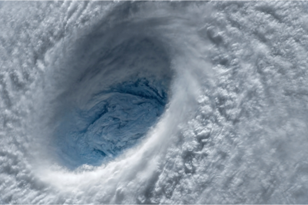
AccuWeather reports that a new hurricane watch was issued along the eastern coast of Florida on Monday as Subtropical Storm Nicole churned across the Atlantic and showed signs of further strengthening as it tracked toward the storm-weary state. AccuWeather meteorologists expect this sprawling storm to take a turn and hit Florida’s east coast — as a hurricane — later this week before it takes a run up the Eastern Seaboard. On Monday, a state of emergency was declared in anticipation of Nicole’s arrival.
The Sunshine State faces long-duration impacts from pounding surf, strong winds and torrential rain, and as a result, so far AccuWeather forecasters have rated Nicole a 1 on the AccuWeather RealImpact™ Scale for Hurricanes. This scale takes into account the effects of storm surge, coastal erosion, flooding, wind and economic damage, while the Saffir-Simpson Hurricane Wind scale accounts for wind intensity only.
Nicole will strengthen into a hurricane prior to making landfall along the central Florida coast late Wednesday night or early Thursday. Impacts could be severe along Florida’s Atlantic coast and over the Florida Peninsula in general. Tropical storm and storm surge watches were also issued for as far north as coastal areas of Georgia.
As of Monday afternoon, Nicole continued to pack 45 mph sustained winds and was spinning 465 miles east of the northwestern Bahamas. It was moving northwestward at 9 mph.
According to AccuWeather meteorologists, the combination of Nicole’s perpendicular track straight into the Florida Peninsula, a broad area of strong easterly winds from the Atlantic and the astronomical effects of the full moon will hit coastal areas hard from near West Palm Beach to St. Augustine and Jacksonville Beach.
Along much of the Florida Atlantic coast and the Georgia coast, conditions could be more severe with Nicole then they were even compared to Ian. Tides will continue to trend above normal through Wednesday and into Thursday. A water level rise of several feet is likely near and well north of where the center of the storm moves inland. A broad zone of where a storm surge of 3-6 feet is forecast from near West Palm Beach to near Savannah, Georgia. From near the Space Coast to Daytona Beach the storm surge can be locally higher than 6 feet.
“In coastal areas, especially from the Space Coast of Florida through the Carolinas, tropical-storm-force wind gusts can occur for 36-48 hours straight,” AccuWeather Director of Forecasting Operations Dan DePodwin said. “This is a longer duration than typical tropical systems.”
Many of the beaches and some of the dunes have been torn up in the wake of Ian’s indirect impacts and could be especially vulnerable to a direct assault by a tropical storm or hurricane coming in from the east.
Although, AccuWeather forecasters do say there is a chance the center of the storm could track farther to the south or to the north. A track farther to the south along the eastern coast of Florida could bring more significant impacts in terms of coastal flooding and wind to Fort Lauderdale and Miami while a track more to the north could bring more severe conditions from the Florida Space Coast to the Jacksonville Beach area
Because of Nicole’s projected track and strength while pushing westward across the Florida Peninsula prior to the end of the week, conditions in Ian-ravaged areas of southwestern Florida will be on par with a moderate tropical storm with squally showers and thunderstorms and minimal water level rise.
However, with any tropical system that makes landfall, there is a risk of severe thunderstorms including isolated tornadoes and waterspouts. This risk includes much of the southern and central parts of the Florida Peninsula and Keys.
“It is extremely unusual for tropical storms to hit the east coast of Florida in November,” AccuWeather Senior Weather Editor and meteorologist Jesse Ferrell said. “Besides the 1935 Miami Hurricane, the only other storm [to hit Florida’s east coast during the month] was an unnamed system in 1946.”
For now, all storm-weary Florida and Georgia residents can do is prepare and wait.
—
Photo Credit: Evgeniyqw / Shutterstock.com
