This winter the arctic blasts just won’t stop, and things are about to get worse before they get better. As AccuWeather reports, life-threatening cold air will continue to surge across the central United States through midweek and build into the East into the end of this week before it begins to ease up, adding it will put pressure on energy demands and household budgets.
The magnitude of the cold air will be painful, dangerous and damaging in some cases. Actual temperatures struggled to reach zero Fahrenheit over a large portion of the northern Plains Tuesday afternoon and were 20-40 degrees below the historical average for the middle of February.
The frigid air was being drawn southward across the Great Plains as a winter storm spread snow and ice over part of the region. The coldest conditions will continue to spread behind the winter storm as it travels eastward Wednesday and off the Atlantic coast Thursday.
In the immediate wake of the snowstorm in Oklahoma City on Wednesday morning, the actual temperature was hovering just above zero F. However, temperatures were flirting with 30 below zero with a landscape that resembled the Arctic Tundra rather than central Oklahoma thanks to blowing and drifting snow.
Exposure to cold air and any breeze can create dangerous to life-threatening temperatures. Those not properly dressed, especially those with exposed skin, are at a high risk of frostbite and hypothermia. The cold will penetrate into portions of the South Central and Southeast states enough to raise the risk of frozen and burst pipes and water mains.
Pittsburgh, which will not even be in the core of the frigid air, has not been above the freezing mark since late Sunday afternoon and may not climb above freezing until Saturday afternoon. The typical high temperature in Steel City is near the 40-degree mark. Even though there is a significant amount of ice on the Great Lakes, enough ice-free areas remain to trigger bands of locally heavy lake-effect snow.
Gradually, the tight grip from the Arctic air will ease starting late in the week over the Plains and then into the East this weekend. Where the sun is out and winds are light during the day, it may feel considerably warmer for a few hours.
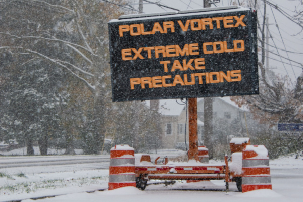
Despite the severity of the cold air, it is not directly associated with the polar vortex. AccuWeather meteorologists continuously monitor this storm near the North Pole that keeps the coldest air in the Northern Hemisphere locked up. When the polar vortex weakens, or changes shape, a major discharge of cold air can occur at lower latitudes.
Sometimes, as is the case this week, a large high pressure area from the Arctic moves southward without any real assistance from the polar vortex.
—
Photo Credit: Alan Budman / Shutterstock.com