NOAA’s Climate Prediction Center has issued a “La Niña Watch.” But what does that mean for weather where you are?
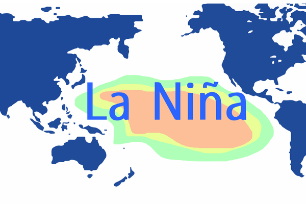
As AccuWeather reports, a La Niña pattern develops when sea surface temperatures in the eastern Pacific Ocean remain cooler than average for an extended time. Its influence on the weather in the United States is strongest in winter, shaping storm tracks and temperature patterns, but it also plays a major role in fueling tropical development during Atlantic hurricane season.
A “La Niña Watch” means that La Niña conditions are expected the next six months. While there will be some La Niña conditions from late autumn through midwinter, a La Niña is only officially declared after five consecutive months of negative sea surface temperatures.
La Niña vs. the U.S. Winter forecast
La Niña is only one of a handful of atmospheric factors that AccuWeather‘s Long-Range team uses to predict the upcoming winter weather. AccuWeather Lead Long-Range Expert Paul Pastelok says, “La Niña conditions can set in during this fall through midwinter time period, but the signal will be weak, and other signals could be more dominant than the typical outcome.”
La Niña typically alters the jet stream in ways that shape very different winters across North America. In the Northwest and western Canada, two storm tracks often converge, leading to colder-than-average temperatures and above-normal precipitation, Pastelok explained. Farther east, the northern branch of the jet stream tends to carry faster-moving, less intense storms, which can mean snowfall near or even below average, with temperatures closer to seasonal norms.
Other factors could spoil La Niña effects
Another factor could spoil typical La Niña winter effects in the U.S. This season, a massive marine heat wave stretches from Asia to the West coast of the U.S. and could impact the normal storm track from La Niña, bringing different results, says Pastelok. “This could possibly result in more snow and cold farther east over the Plains, Midwest and occasionally in the Northeast.” Exactly who ends up with more or less snow than average will come down to the fine details.
La Niña vs. the end of the Atlantic hurricane season
“The chances of La Niña conditions greatly increase late in the 2025 Atlantic hurricane season, especially in October and November,” AccuWeather Lead Hurricane Expert Alex DaSilva said. “This favors an active end to the hurricane season.”
When a La Niña phase occurs, less frequent wind shear occurs in the regions of the Atlantic basin where tropical weather develops, increasing the potential for more storms.
—
Photo Credit: Adansijav Official / Shutterstock.com