A developing El Niño will be one of the biggest forces shaping the 2026 Atlantic hurricane season, which officially begins on Monday, June 1, and is one reason the number of storms could be near to below historical averages. Still, hurricane preparedness is critical as multiple storms could make landfall in the United States this season.
As AccuWeather reports, the 2025 hurricane season was close to the historical average in terms of the number of storms, but it featured three Category 5 hurricanes, just one shy of the all-time record of four. Additionally, most of the tropical activity occurred after Sept. 10, the climatological peak of the hurricane season.
“It’s very important that everybody from South Texas all the way to Maine prepares equally for each and every hurricane season, regardless of what the official forecast is,” AccuWeather Lead Hurricane Expert Alex DaSilva said. “Even if it’s expected to be a slightly below average hurricane season, we can still see major hits across the United States.”
El Niño could Slow Tropical Activity, especially Late in Season
The 2026 Atlantic hurricane season will be shaped by a shifting climate pattern in the Pacific Ocean.
El Niño occurs when ocean temperatures near the equator of the eastern Pacific Ocean warm to at least 0.5 of a degree Celsius (0.9 of a degree Fahrenheit) above the long-term averages. The warmer the water in this area of the Pacific, the greater the effect it will have on tropical activity worldwide.
Typically, El Niño creates stronger upper-level winds (wind shear) across the Atlantic, making it harder for tropical storms to take shape. With El Niño forecast to develop and strengthen throughout the summer and autumn, it is likely to translate to fewer storms during the second half of the hurricane season compared to the first half.
There is about a 15% chance that a “super El Niño” will develop if ocean temperatures near the equator of the eastern Pacific rise at least 2 degrees Celsius (3.6 degrees Fahrenheit) above long-term averages. If it does happen, it could sharply reduce storm activity in late October and November.
The last time there was an El Niño during the Atlantic hurricane season was 2023, which was busier than normal with 20 named storms, above the historical average of 14. “What made 2023 very special is it was also the warmest year on record if we take a look at the average sea surface temperatures across the Atlantic basin,” DaSilva explained. Waters across the Atlantic are expected to be warm throughout 2026, though not as high as in 2023.
Forecast Numbers are Near to Below Average, but not Risk-Free
AccuWeather is predicting 11 to 16 named storms, including four to seven hurricanes and two to four major hurricanes, which are Category 3 or higher. Forecasters also expect three to five direct impacts on the United States throughout the 2026 Atlantic hurricane season. For comparison, the historical average is 14 named storms, seven hurricanes and three major hurricanes.
A direct impact to land can occur even if a storm doesn’t make landfall. It can also include tropical-storm-force winds reaching land, flooding rain from a storm just offshore, or a storm surge of at least 2 feet along the coast.
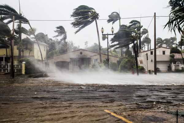
Hurricane Erin is a prime example of a high-impact storm that didn’t make landfall. In August 2025, pounding waves and storm surge from the hurricane caused severe beach erosion along the Atlantic Seaboard. By the end of the season, multiple houses had collapsed into the ocean following Erin and other coastal storms.
Although AccuWeather is predicting a near- to below-average number of tropical storms and hurricanes this year, 2026 could still be fairly active compared to other El Niño years.
Since the start of the satellite era in the 1960s, El Niño years have averaged about 10 named storms and five hurricanes. That is well below the historical average during La Niña years, which typically produce around 15 named storms and eight hurricanes. In years when neither El Niño nor La Niña is present, the average is 13 named storms and seven hurricanes.
Even with numbers near or below historical averages, the season can still turn destructive. The 1992 hurricane season is a prime example, as there were only seven named storms that year. However, the season is infamous due to Hurricane Andrew, one of the most powerful hurricanes to ever strike the U.S.
Rapid Intensification is a Concern in 2026
“This year we are very concerned about rapid intensification, very similar to the last couple of years,” DaSilva said. The risk of fast-strengthening storms and hurricanes is tied to the abundance of warm water, which serves as the fuel for storms.
The concern is not just warm water at the ocean surface. The warm water also extends deeper below the surface, known as ocean heat content.
“Those waters are also exceptionally, exceptionally warm,” DaSilva said, adding that the warm water is hundreds of feet deep across most of the hurricane basin. “That is why once again we are very concerned about rapid intensification this upcoming hurricane season.”
These Areas in the U.S. are at Greatest Risk of Direct Impacts
The areas of the U.S. at greatest risk of direct impacts from a tropical storm or hurricane in 2026 are the northern and northeastern Gulf Coast and the Carolinas.
To make the landfall risk forecast, AccuWeather forecasters looked back at past years with weather patterns similar to what is expected this season. In years such as 2009, 2014, 2018 and 2023, tropical storms and hurricanes brought more impacts to these areas than to other parts of the Gulf and Atlantic coasts.
The risk of significant tropical impacts is lower along the Texas coast, but that does not mean the state is in the clear. In 2023, one of the only storms to make landfall in the U.S. was Tropical Storm Harold, which impacted southern Texas.
Is there a Chance we could see Hurricanes Before June 1?
Forecasters are also keeping a close eye on the weeks before and just after the official start of the Atlantic hurricane season on June 1. With warm waters firmly in place in the areas where storms typically develop early in the season, it may not take much to have tropical activity fire up around the same time that the season officially gets underway.
The early part of the hurricane season is when “homegrown development” is most frequent. This can happen if a storm or front that moves across North America stalls over the Gulf, western Caribbean or western Atlantic Ocean. As it sits over warm water, it may eventually transform into a tropical depression, tropical storm or even a hurricane.
When storms develop so close to land, it means there is less time for coastal residents to prepare for potential impacts.
Other Factors Affecting the 2026 Season
El Niño will not be the only influence on tropical storms and hurricanes in 2026. Another factor is the position of the Bermuda High. DaSilva said it may sit a bit farther south and east again this year, similar to last season. That setup can allow more storms to curve away from the U.S., especially in the western Atlantic.
Forecasters are also watching for periods of dry Saharan dust and changes in the flow of tropical waves coming off Africa. Those factors could, at times, slow development in the main area where storms usually form across the Atlantic.
—
Photo Credit: FotoKina / Shutterstock.com