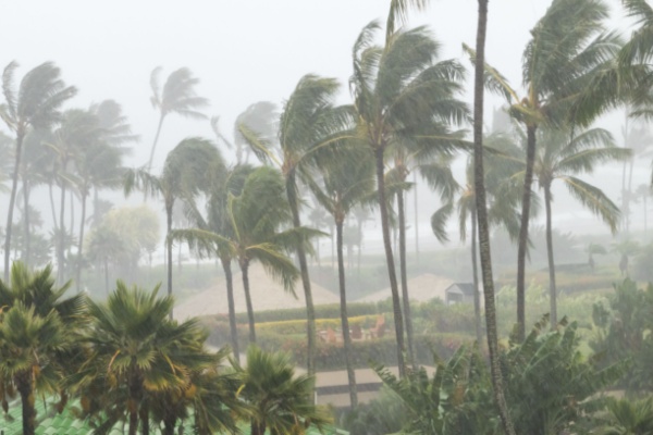
Around this time of year, the story is usually about all of the tropical storms and major Hurricane activity in the Atlantic, while the Pacific gets hit with maybe a strong storm or two. But thanks to the influence of the Super El Niño, this year is a completely different story.
While tropical storm Edouard did make landfall near the Texas-Louisana border on Tuesday, unleashing maximum sustained winds of 60 mph, knocking down thousands of power lines, toppling trees and flooding roads with heavy rain, it’s not nearly what the Gulf and East Coast are used to getting this time of year.
Meanwhile, two major hurricanes and another tropical storm with increasing velocity are churning in the Pacific Ocean this week: Karina, Lowell and Marie.
How Fast Is Hurricane Lowell Growing?
On Tuesday, Hurricane Lowell was a Category 4 major hurricane. Lowell began as a tropical storm on Sunday, reaching winds of 50 mph, roughly 985 miles east-southeast of Hilo, Hawaii. But then Hurricane Lowell exploded to Category 5 strength on Wednesday afternoon with 160-mph winds, and its forecast track is shifting north, putting Hawaii in growing danger later this week.
Lowell is only the seventh hurricane on record to reach Category 5 in the central Pacific, and the first since Hurricane Walaka in 2018. The storm went from a 70-mph tropical storm to a 160-mph monster in just over 30 hours, one of the most rapid intensifications the basin has seen.
As of Wednesday afternoon, Lowell was about 445 miles south of Hilo, moving west at 10 mph. Lowell is likely not done intensifying. In its Wednesday afternoon update, the Central Pacific Hurricane Center noted that the storm is, “moving over a region of very high oceanic heat content in a low shear environment, further near-term intensification remains possible.”
What’s more concerning is what Lowell does over Labor Day weekend. The Central Pacific Hurricane Center warned that the storm is likely to take “a sharp turn toward the north or north-northeast” by Sunday. That would take the storm dangerously close to the western Hawaiian islands, potentially still at major hurricane strength.
Hurricane Karina Stirs it Up with Lowell
About 1,000 miles to the east, Hurricane Karina held strong as a Category 4 storm with 145-mph winds, moving west-northwest. The rare sight of two major hurricanes operating so close together highlights a troubling reality. Pacific ocean temperatures are extraordinarily warm, supercharged by a rapidly strengthening El Niño.
Karina is expected to weaken over the next several days. But that storm will ultimately have an impact on where Lowell ends up.
The atmospheric pattern over the Pacific Ocean is very active and dynamic right now. A storm system over the central Pacific, remnants of former hurricane Etau will intensify and dig southward towards Hawaii over the weekend. That storm system will first run into Karina, absorbing what’s left of the storm, and then will bend the jet stream, capturing hurricane Lowell and directing the storm towards Hawaii late this weekend.
Hawaii is still recovering from the impacts of Hurricane Lala, which brushed past the southern part of Big Island, bringing destructive winds and severe flash floods.
And then there’s Marie
Meanwhile, Tropical Storm Marie continued to gain strength off the coast of Baja California on Wednesday as it churned northward on a path that could bring rain and high surf to Southern California. As of Wednesdsay morning, the eye of the storm was southwest of Cabo San Lucas with sustained winds of around 75 mph, and Marie was expected to reach hurricane strength later in the day.
At this point, the National Weather Service (NWS) does not expect Marie to make landfall in Southern California. However, forecasters note “quite a bit of uncertainty” regarding its potential impacts. “The chances of Marie directly hitting the West Coast as a hurricane or tropical storm remain VERY LOW,” NWS forecasters said. “However, despite the HIGH likelihood of Marie maintaining a west to northwest track away from the West Coast, there still be some noticeable impacts for the area from this storm.”
Heavy surf and high tides are expected to be a more significant concern, especially over the Labor Day weekend when hundreds of thousands of people flock to area beaches. The Weather Service said high surf advisories are likely to be issued for south-facing beaches, with strong rip currents expected. Evening high tides of around 7 feet are possible, creating the potential for beach erosion and coastal flooding. Coastal flood advisories are also possible.
El Niño is the Reason for the Season
According to World Weather Online, the Atlantic hurricane season runs from June 1 through Nov. 30 each year. The Eastern Pacific hurricane season is from May 15 through Nov. 30. Peak activity usually occurs between mid-August and mid-October.
In the 2026 Atlantic Hurricane Season Outlook Summary, forecasters predicted a 75% chance of below-normal activity for the region, while the Pacific was expected to see a 70% chance of higher-than-average. The Pacific Hurricane forecast calls for 15 to 22 named storms, 9 to 14 hurricanes, and 5 to 9 major hurricanes. Moreover, seasonal storm energy is also expected to reach 120% to 190% of the median.
El Niño often reduces Atlantic hurricane activity by increasing vertical wind shear. In simple terms, wind shear means winds blowing at different speeds or directions at different levels of the atmosphere. Tropical storms need a stable vertical structure to grow. Strong wind shear can tilt or tear storms apart before they become powerful hurricanes.
While El Niño often enfeebles Atlantic hurricane activity, it can do the opposite in the eastern Pacific. Warmer waters and more favorable atmospheric conditions can help tropical cyclones form, intensify, and last longer. That explains why the eastern Pacific outlook is much more active. The forecast of 15–22 named storms and 5–9 major hurricanes means the basin could see several dangerous systems, especially near Mexico’s Pacific coast (due to its high vulnerability) and open ocean shipping or travel routes.
“El Niño warming sets the stage for these storms, which are fuelled in large part by warm waters — when the tropical Pacific is warmer than normal we see an increase in strong storms,” climate scientist Julia Cole of the University of Michigan said in an interview with AFP. A train of three cyclones “is definitely rare to see,” she added.
A similar train of four cyclones happened in 2015, another intense El Nino year when Typhoon Kilo, Hurricane Ignacio, Hurricane Jimena and Tropical Depression 14E all worked their way west across the Pacific at once.
This year’s El Niño has a 69 percent chance of becoming the strongest on record, according to the National Oceanic and Atmospheric Administration, and is already unleashing extreme weather across the globe even though it is not expected to peak until sometime around November.
—
Photo Credit: Ryan DeBerardinis / Shutterstock.com
