A major arctic outbreak spurred by a brutal polar vortex is stretching from the Midwest to the Northeast, bringing bringing dangerously low temperatures, arctic wind chills, and potential blizzards to several regions, affecting 43 million Americans.
In what’s being called an “epic, generational arctic blast,” a brunt of the cold snap is impacting the Midwest, Northeast, and Plains states, but its reach extends into the South and even parts of the West Coast. Cities like Chicago, Minneapolis, Buffalo, Denver, and Dallas are bracing for significant impacts.
On Monday morning, the wind chill — what temperature it feels like — plunged to minus 30 degrees in Minneapolis; minus 27 degrees in Cedar Rapids, Iowa; minus 22 degrees in Chicago; and minus 22 degrees in Green Bay, Wisconsin. The brutal Midwest wind chill continued on Tuesday morning, hitting minus 13 degrees in Chicago; minus 23 in Green Bay; and minus 12 in Cleveland.
The freeze hit the Northeast on Tuesday morning, with the wind chill dropping to minus 11 degrees in Pittsburgh, Pennsylvania; 7 degrees in Washington, D.C.; and 5 degrees in New York City.
The Arctic blast is also bringing heavy lake effect snow to the Midwest and Northeast. The heaviest lake effect snow is expected in western Michigan and western and upstate New York where, 6 to 12 inches of snow is forecast. Temperatures are expected to plummet well below freezing, with some areas experiencing wind chills below -40°F (-40°C).
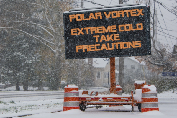
Travel Impacts
Blizzard warnings have been issued for several states, including parts of Minnesota, Wisconsin, North Dakota, and South Dakota. These warnings signify the potential for dangerous snowfall combined with strong winds, creating near-zero visibility and treacherous travel conditions.
Major disruptions are expected on the roads and in the air. Airlines have already preemptively canceled thousands of flights, and road closures due to snow and ice are likely. It’s crucial to exercise caution and avoid unnecessary travel during this time.
Freezing the Power Grid
Can the Grids Hold Up? Freezing temperatures and heavy snowfall can increase the risk of power outages. The arctic blast isn’t just delivering record-breaking chills, it’s also raising concerns about the ability of power grids across the affected states to withstand the increased strain.
Texas, still haunted by the February 2021 blackout that left millions in the dark, is under intense scrutiny. While grid officials assure improved winterization efforts and increased natural gas supplies, fears linger. The Electric Reliability Council of Texas (ERCOT) anticipates record electricity demand, possibly exceeding the 2022 peak. This strain, coupled with potential equipment failures caused by extreme cold, could trigger rolling blackouts or even worse.
The interconnected nature of the U.S. power grid means an issue in one region can have a domino effect into others. For instance, an overload in Texas could affect the Midcontinent Independent System Operator (MISO) region, impacting areas from Minnesota to Louisiana. This domino effect could trigger widespread outages, leaving millions vulnerable to the freezing temperatures.
The consequences of grid failure go beyond inconvenience. Businesses could face closures and financial losses, impacting supply chains and potentially leading to higher consumer prices. Additionally, hospitals and other critical infrastructure rely on consistent power, adding a layer of urgency to the situation. People with compromised health or limited access to resources are particularly vulnerable, and communities could scramble to establish warming centers and emergency shelters.
Grid operators are taking measures to mitigate risks, including implementing rolling blackouts as a last resort and urging consumers to conserve energy. Public awareness campaigns and emergency preparedness efforts are crucial to help individuals and communities weather potential disruptions.
It’s too early to predict with certainty the magnitude of the grid’s response to the arctic blast. However, the potential for widespread outages underlines the urgency of ongoing infrastructure upgrades and grid modernization efforts. As the cold air descends, the U.S. stands at a crossroads, facing the test of its resilience and preparedness against a powerful natural phenomenon.
Health Risks and How to Stay Safe
These extreme wind chills can cause skin to freeze in as little as five minutes, posing a serious health risk.
Health experts advise taking the following safety measures:
- Dress in layers for extreme cold, including gloves, hats, and scarves.
- Stay indoors if possible, and limit outdoor exposure when temperatures are dangerously low.
- Check on vulnerable neighbors and family members who may need assistance.
- Keep your home warm and ensure your carbon monoxide detectors are functioning properly.
It’s crucial to stay up-to-date on the latest weather advisories and warnings for your area. Resources like the National Weather Service website and local news outlets can provide valuable information.
This arctic blast is a serious weather event with the potential for significant disruptions. Stay informed about local alerts and advisories, prepare emergency kits, stock up on supplies like extra food, water, double up on warm clothing, and follow official recommendations for energy conservation.
Going to Get Worse Before it Gets Better
Unfortunately, this brutally frigid weather won’t be over anytime soon, and is expected to last at least into next week. “This first shot of cold air over the weekend and into early next week looks to be the appetizer, with the main course of cold coming the following week,” said MIT climatologist Judah Cohen in an email to USA Today on Jan. 14. “I think there is potential for the second round of cold air to be more extreme.
Another expert, Weather Trader meteorologist Ryan Maue agreed, noting this week that although “this is two weeks in the future, so the details and intensity will change, but we are poised to see a potentially historic Arctic ‘polar vortex’ blast across North America into the end of January.”
A Stretched Polar Vortex
As USA Today reports, a polar vortex is not a storm − it’s a large-scale, persistent area of low pressure and extremely cold air that sits high in the atmosphere over both of Earth’s poles, according to the National Weather Service. It exists year‑round, but it strengthens in winter when polar temperatures drop, and weakens in summer.
When the vortex is strong, that cold air stays bottled up over the poles. However, when the vortex weakens, stretches or becomes disrupted, pieces of that unspeakably cold air can spill southward into the U.S., Europe or Asia, producing outbreaks of frigid Arctic air. That’s what is happening in January.
This is a rapidly evolving situation. Together, we can navigate this challenging weather event with awareness and preparation. By staying informed, taking precautions, and prioritizing safety, you can navigate this cold snap safely and effectively.
—
Photo Credit: Alan Budman / Shutterstock.com