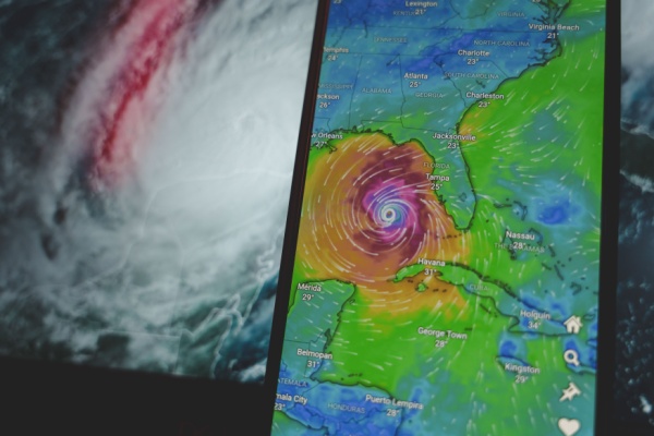
After a relatively slow start to the 2025 Atlantic hurricane season, activity is beginning to pick up around mid-month as we approach the busiest time of the year for tropical systems. The Atlantic typically sees an increase in named storms during August, ahead of the season’s climatological peak September 10.
NOAA Stands By It’s May Predictions for an Above-Average Season
Regardless of the slow start to the 2025 season, forecasters from NOAA’s National Weather Service (NWS) updated the number of expected named storms to 13-18 (with winds of 39 mph or greater), of which 5-9 could become hurricanes (winds of 74 mph or greater), including 2-5 major hurricanes (winds of 111 mph or greater).
The adjusted ranges are for the entire season from June 1 though November 30, and are inclusive of the four named tropical storms that have already formed. In the Atlantic basin, a typical hurricane season will yield 14 named storms, of which seven become hurricanes and three become major hurricanes.
The likelihood of above-normal activity is 50%, a 35% chance of a near-normal season, and a 15% chance of a below-normal season. This updated prediction is similar to the initial outlook issued in May.
“NOAA stands ready to provide the forecasts and warnings that are vital for safeguarding lives, property, and communities,” said Acting NOAA Administrator Laura Grimm. “As we enter the second half of the season, this updated hurricane outlook serves as a call to action to prepare now, in advance, rather than delay until a warning is issued.”
August Awakening is Right On Cue
Climatologically, this increase in activity is right on cue. August typically brings a sharp rise in the number of named storms as sea surface temperatures heat up across the Atlantic basin. Warmer water above 80 degrees Fahrenheit provides an abundance of fuel for tropical systems to consume, and has been cited as one of the main drivers behind rapid intensification of hurricanes.
As of Aug. 5, sea surface temperatures are two to four degrees Fahrenheit above normal across much of the tropical Atlantic basin, with water temperatures as warm as 90 degrees off the southwest coast of Florida.
Warm water isn’t the only factor in hurricane development; the atmospheric conditions need to be favorable for a cluster of tropical showers to turn into one of nature’s most powerful phenomena. As wind shear decreases over the tropics in late summer and early autumn, developing storms essentially have little to stop them from strengthening into tropical cyclones.
Atlantic basin tropical storm activity is expected to be elevated due to a combination of factors, including warmer-than-average sea surface temperatures in the tropical Atlantic Ocean and Caribbean Seas, and an active West African Monsoon. Large-scale weather patterns like El Niño can often dull the activity in the Atlantic, but the absence of those inhibiting factors this year has most seasonal forecasts still calling for an above-normal season.
ENSO-neutral conditions are expected to continue, meaning there is neither an El Nino nor La Nina to influence this season’s storm activity. “Many of the factors we identified ahead of the season are still at play, and conditions are largely tracking along with our May predictions,” said Matt Rosencrans, lead hurricane season forecaster with NOAA’s National Centers for Environmental Prediction, part of the National Weather Service.
All It Takes is One
As CT Insider reports, regardless of how the season shapes up, it only takes one destructive storm to make for a memorable hurricane season. For example, 1992 was an extremely quiet season overall with only six named storms, but the only major hurricane (Andrew) became a household name after making landfall in South Florida as a Category 5 and causing $26 billion in damage ($60 billion in today’s dollars).
According to the NOAA, so far, the 2025 season has produced four named tropical storms and no hurricanes. Tropical Storm Chantal made the first U.S. landfall of the season and brought high winds and deadly flooding to the Carolinas during the Independence Day holiday weekend.
“No two storms are alike,” said NOAA’s National Weather Service Director Ken Graham. “Every storm presents unique, life-threatening hazards that can impact people in both coastal and inland communities. Have a plan in place, and know the actions you should take before, during and after the wide range of hazards that the hurricane season can bring.”
The takeaway? Whether you live on the Connecticut shoreline or the Florida Keys, being prepared for hurricane season is essential. Have a plan for evacuations, make sure your home insurance is up to date, and pay attention to forecasts from the NOAA’s National Hurricane Center.
The next names on the list for the 2025 Atlantic hurricane season are Erin, Fernand and Gabrielle.
—
Photo Credit: Rokas Tenys / Shutterstock.com