Over halfway into the first month of the 2024 hurricane season, activity has ramped up in the Atlantic. Abnormally warm waters across portions of the Caribbean Sea and Gulf of Mexico have helped to promote prime conditions for tropical development this week, with another chance of formation forecast by late week.
As AccuWeather reports, meteorologists are closely monitoring the first tropical storm of the season, Alberto, that is expected to make landfall in northeastern Mexico early Thursday morning. Alberto was named Wednesday morning, June 19th, as it tracked across the western Gulf of Mexico.
A tropical storm warning was issued for locations along the Texas Gulf Coast and the northeastern coast of Mexico Tuesday morning. A tropical storm warning indicates that tropical storm conditions are expected within the warning area within 36 hours.
“Abnormally warm waters and a pocket of relatively low wind shear located in the Bay of Campeche allowed for Alberto to gain enough organization on Wednesday to be upgraded to tropical storm status,” explained AccuWeather Meteorologist and Lead Hurricane Forecaster Alex DaSilva.
On average, the first tropical storm forms in the Atlantic Ocean by June 20. With Alberto developing into a tropical storm on June 19th, this season is progressing right on schedule. Heavy coastal rain and flooding are expected to occur across northeastern Mexico, southern and eastern Texas and Louisiana through Thursday.
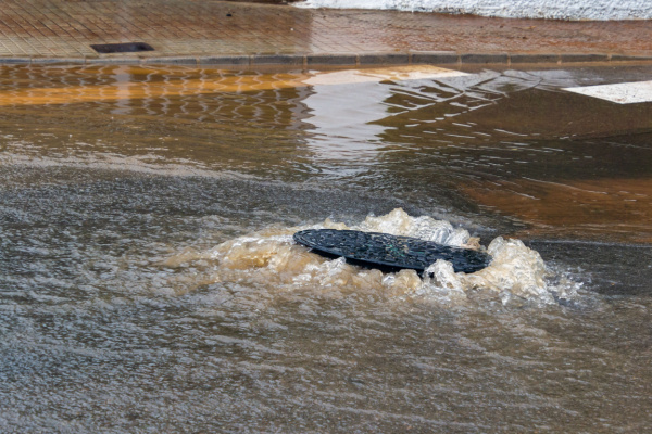
Rounds of Intense Downpours
Between 4-8 inches of rain can fall across a widespread area from south of Houston to far northeastern Mexico from Monday to Thursday night, while rainfall totals as high as 8-12 inches can occur over South Texas and the higher elevations of northern Mexico. The AccuWeather Local StormMax™ for rainfall is currently set at 30 inches.
Tropical wind gusts are forecast to reach speeds of 40-60 mph along the coastline from northeast Mexico to the far southwest coast of Louisiana. The winds will create rough and dangerous surf along the coast, and mariners are cautioned to secure their vessels safely and steer clear of the hazardous conditions created by this feature as it tracks closer to land.
The strongest gusts from Alberto can occur along the far southern tip of Texas and directly along the coast of northeastern Mexico by midweek. The AccuWeather Local StormMax™ for wind gusts is 75 mph.
In addition to the threat of wind and rain across portions of Mexico and Texas, forecasters warn that mudslides can occur throughout the mountainous terrain of Mexico. Due to impacts across eastern Mexico, the AccuWeather RealImpact™ Scale is set at 1.
Storm surge along the northeastern Mexico, Texas and western Louisiana coastlines will generally range between 1-3 feet. Locations around Houston and Galveston in Texas are projected to face higher levels of storm surge, reaching up to 3-6 feet in some low-lying areas.
Residents are urged to heed any warnings given by professionals and emergency management personnel. Storm surges can last for days, result in extensive damage, and be one of the greatest threats to life as a storm impacts a region. Due to the impacts of storm surge, rain and wind, the AccuWeather RealImpact™ Scale for the U.S. is 1.
Additional tropical development is on the Horizon
Later this week, another tropical system may ramp up across the Bay of Campeche and Gulf of Mexico. Forecasters say that a “rinse and repeat” of the early to midweek pattern can occur across the northeast Mexico and South Texas coastlines.
“There is a moderate chance for development from June 21-23 across a similar area in the Gulf of Mexico. This feature will need to be watched for possible impacts on the Gulf coasts of the United States and Mexico this weekend into early next week,” explained AccuWeather Meteorologist Andrew Kienzle.
—
Photo Credit: Fernando Astasio Avila / Shutterstock.com