As a heat dome dominates much of the central and eastern United States this week, clusters of thunderstorms will cruise its periphery. As AccuWeather reports, they could bring locally damaging thunderstorms and flash flooding.
A heat dome is a meteorological phenomenon where a strong, persistent high-pressure system in the upper atmosphere taps a large mass of hot air and moisture over a region, acting like a lid on a pot. It prevents the heat from escaping, causing temperatures to soar to dangerous, record-breaking levels for days or weeks.
With some exceptions, most thunderstorm activity in the central, eastern and southern United States during the last days of June and the first days of July will form a large circle surrounding a hot high-pressure system in the middle. The main reason it’s called a “ring of fire,” is that the center of the high tends to suppress thunderstorms, so they form where the high is weakest, on the edges—the circulation around the high causes groups of storms to drift clockwise.
Since some of the groups of thunderstorms will pass over the warm waters along the southern Atlantic and Gulf coasts, there could even be enough time for a tropical depression or tropical storm to organize this week.
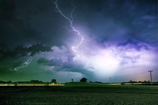
As the high-pressure area and corresponding heat dome strengthen, the risk of powerful, fast-moving thunderstorm complexes will increase on their northern and northeastern flanks. In some cases, intense, long-lasting severe thunderstorms, called derechos, may be possible.
A derecho isn’t your average thunderstorm. While it may look like a cluster of severe storms, what sets it apart is its sheer size, speed, and destructive reach. The term “derecho” comes from the Spanish word for “straight,” a nod to the powerful, straight-line winds that define this phenomenon. In contrast, “tornado” comes from the Spanish word meaning “to turn,” highlighting the key difference in wind behavior.
Derechos are often called “inland hurricanes” for good reason — they unleash hurricane-force winds, torrential rain, and widespread destruction. However, the two types of extreme weather form in very different ways. While a derecho may look like an inland hurricane on radar and satellite images, and seem like the same in person with its combination of strong winds and torrential rain, the meteorological community has criteria that determine whether or not a thunderstorm complex has achieved the “d-word” level.
A long-tracking, intense supercell thunderstorm affected a small part of the Plains from Sunday night to Monday morning. This storm produced wind gusts to 131 mph. If verified, this is the second-highest thunderstorm wind gust recorded in the U.S. The overall area affected by this storm is smaller than that of a typical derecho.
For the rest of the week leading into the 4th of July holiday, a huge swath of the country, from the midwestern region through the eastern coast could see thunderstorms, flash flooding, hail and heavy rains, damaging winds, and even isolated tornadoes.
People are urged to keep alert for fast-changing conditions and closely monitor weather bulletins, especially if they will be spending a great deal of time outdoors camping, fishing, golfing or at the beach.
—
Photo Credit: Virrage Images / Shutterstock.com
