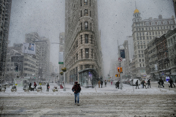
A storm will rapidly intensify along the Atlantic Coast of the United States this weekend and is forecast to bring accumulating snow to parts of the Southeast and a close call with heavy snow along the mid-Atlantic and New England coasts. As AccuWeather reports, the powerful storm will raise winds and seas, leading to significant coastal flooding and beach erosion. Blizzard conditions are also likely in the hardest-hit areas.
Storm to take shape in Southeast on Friday
As the storm develops on Friday in the southern U.S., spotty rain will break out along the Gulf coast, the Florida Peninsula and the southern Atlantic coast. Farther inland over Mississippi, Alabama, Tennessee, Georgia and the Carolinas, the patches of snow or a mixture of rain and snow will unfold.
As the storm strengthens from Friday night into Saturday, the extent and intensity of snow and wintry mix will increase across Georgia and the Carolinas. There is a high chance that at least an inch of snow will fall on much of North Carolina, northern South Carolina and southern Virginia from the storm from late Friday through Saturday.
As heavy snow impacts major airport hubs from Charlotte to Boston this weekend, airline delays will mount, and travel along a portion of Interstate 95 may slow to a standstill in some areas.
The Biggest Snowstorm in Decades
For cities such as Charlotte and Raleigh, and Greensboro, North Carolina, AccuWeather meteorologists say this could be the biggest snowstorm in decades.
In Charlotte, the most recent benchmark storm was 3.5 inches on Jan. 17, 2018, and this weekend’s storm is well within reach. Going farther back, a storm in late February of 2004 was one of the biggest on record, with 13.2 inches falling. In late January of 2003, a storm brought 8.5 inches.
In Raleigh, a storm brought 7 inches on Dec. 9, 2018, and could easily be eclipsed by this weekend’s storm. The biggest snowstorm on record occurred in late January 2000, when 20.3 inches of snow fell. In early January 2002, a storm brought 10.8 inches.
Several inches of snow are forecast across much of North Carolina and southern Virginia. The greatest chance of the storm bringing 6 inches or more in the Southeast states will extend from north-central North Carolina to southeastern Virginia and the southern part of the Delmarva Peninsula.
Blizzard conditions are likely in some areas due to strong winds and low visibility as the evolving nor’easter intensifies into a bomb cyclone.
What’s makes it a “Bomb Cyclone?”
As the storm reaches the southern Atlantic coast on Saturday, it will rapidly strengthen to what meteorologists call a bomb cyclone. This rapidly strengthening storm experiences an atmospheric pressure drop of 0.71 of an inch of mercury (24 millibars) or more in 24 hours or less.
Every year, a handful of fall and winter storms undergo what is known as bombogenesis, becoming bomb cyclones. These storms begin as minor or average storms and then go through a rapid, explosive intensification, delivering heavy snow, blizzards, thundersnow, coastal flooding and flooding rains.
Strong Winds and Coastal Flooding to Top It Off
Where strong winds push water shoreward along the Atlantic coast from North Carolina to New England, tide levels will surge, creating coastal flooding.
Adding to this impact over the weekend will be the proximity of the full moon and normally higher astronomical tides. Because of this, many areas may experience water levels 2-4 feet higher than what would normally occur without a storm.
Locations such as Norfolk, Virginia; North Carolina’s Outer Banks; the Wildwoods of New Jersey and Scituate, Massachusetts, may be flooded with the worst conditions around high tide this weekend.
Battle Between Dry Air to the North & Atlantic Moisture to the South, but Arctic Air will Surge Either Way
The track of the storm relative to the coast will not only determine how much snow falls in the Southeast from Friday to Saturday, but also how far inland heavy snow can penetrate in the mid-Atlantic and New England from Saturday to Sunday as the storm spins over the Atlantic.
AccuWeather meteorologists believe the most likely zone in the Northeast for 6-12 inches of snow will be in southeastern Massachusetts, with 3-6 inches of snow in store for the rest of southeastern New England, Long Island, New York and coastal areas of New Jersey and Delaware.
Along Interstate 95 from northern Virginia to New York City, it will be a battle between dry air to the north and west and Atlantic moisture to the south and east. Instead of I-95 being the approximate dividing line between rain, ice and snow, it will be the boundary between accumulating snow and practically no snow at all. A dozen miles or less may determine the difference between a few flurries to snow covered roads and slippery conditions.
In the wake of the storm, Arctic air will surge southward and eastward once again, sending frosts and freezes deep into Florida and many areas of the continental eastern half of the U.S. back into the deep freeze for days.
—
Photo Credit: David Reilly / Shutterstock.com
