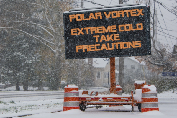
An invasion of frigid air – with links to a “polar vortex” – from the Arctic swept south from the Plains and Ohio Valley Sunday, moving towards the Southeast and East.
Threat level: The colder-than-average temperatures threatens public health for those exposed to the wind and cold, and may harm water and power infrastructure from North Dakota to Texas, on eastward.
As Fox Weather reports, dangerously low wind chills from 30-55 degrees below zero are likely on Sunday and Monday in the Rockies, Upper Midwest and northern Plains, while below-zero wind chills are expected to reach as far south as Oklahoma and the Tennessee and Ohio valleys Sunday night.
- The extreme cold has links to the polar vortex, which is a feature of the winter climate during winter in the Northern Hemisphere.
- “Life-threatening” wind chills down to minus-55°F are likely in the Plains and Upper Midwest, the NWS warns, mentioning the risk of hypothermia and frostbite for people exposed to the cold for too long.
- Sub-zero wind chills are forecast to affect the Ohio and Tennessee Valley Sunday night through midweek, with the possibility of similar cold spreading into portions of the Mid-Atlantic and Northeast in the wake of a winter storm.
Along with the cold, a snowstorm is affecting areas from the Mid-Atlantic to the Northeast on Sunday into Monday. It is poised to potentially become the heaviest snowstorm so far this year for Philadelphia, New York City and Boston, with 5 to 10 inches possible in this broad region.
What they’re saying: “This will be the coldest air of the winter season thus far, and in many cases the coldest in several years,” the NWS warns.
Zoom in: The hazardous cold will be especially disruptive in the South and Southeast, where temperature departures from average will be significant and persistent.
- A rare winter storm is set to deliver a severe snow and ice storm from Houston to Baton Rouge and New Orleans, eastward towards the Carolinas beginning Monday.
- As of Sunday morning, the National Weather Service was calling for about 3 inches of snow to fall in Houston, with up to 5 inches in parts of the metro area.
- About 2 to 3 inches of snow are expected to fall in New Orleans, with 4 to 6 inches in Baton Rouge.
The intrigue: The NWS forecast office in New Orleans is urging residents to “Exercise extreme caution if travel cannot be avoided” due to the cold and snow that is expected.
- “Given the rare southerly track of this winter storm, major traffic and travel disruptions are likely through mid-week,” the NWS stated in an online forecast discussion.
By the numbers: Here’s how some cities will be affected early next week:
- Minneapolis: A high of minus-5°F with a low of minus-13°F on Jan. 22.
- Denver: A high of 6°F and a low of minus-4°F on Jan. 20.
- Dallas: A high of 33°F and a low of 23°F on Jan. 21.
- New York City: A high of 18°F and a low of 10°F on Jan. 21.
- Washington, D.C.: A high of 21°F and a low of 11°F on Jan. 21.
Meanwhile… The Arctic outbreak will result in a blustery and frigid Inauguration Day, with temperatures in the upper teens and wind chills even lower on the National Mall when President-elect Trump takes the oath of office inside the Capitol to protect attendees from the cold.
The intrigue: The cold air may also spill westward into the Great Basin, setting up yet another period of strong, offshore Santa Ana winds in Southern California.
—
Photo Credit: Alan Budman / Shutterstock.com
