AccuWeather meteorologists have warmed that daily rounds of storms will bring the risk of strong winds and flash flooding from portions of the Plains and Midwest to parts of the Northeast early this week. The risk comes from a rare severe weather event known as a derecho that could blast several states and threaten major cities. The combination of extreme heat in place over the south-central United States and ample amounts of moisture will help spark severe thunderstorms through early week along the northern fringes of the heat dome.
All of which begs the question…
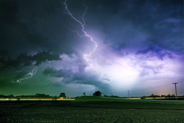
What is a Derecho?
As AccuWeather reports, the term “derecho” derives from the Spanish language and means “straight ahead” or “to the right” when translated into English. In meteorology, the word is used to describe a powerful complex of thunderstorms that tends to race along at high-speed for hundreds of miles and produce damaging straight-line wind gusts.
The official scientific criteria of a derecho, as described by the National Weather Service‘s Storm Prediction Center, pertains to the swath of wind damage that must extend either continuously or intermittently for more than 400 miles with a width of at least 60 miles. AccuWeather meteorologists maintain that whether or not the official criteria are reached during or following an investigation after the event, there is still the potential for widespread damaging wind gusts with significant risk to lives and property when the term is raised as a forecast.
Powerful, long-lived thunderstorm complexes such as derechos can behave very much like inland hurricanes and can cause substantial property damage, major travel disruptions, widespread power outages and, most importantly, dangerous and life-threatening conditions.
While not all thunderstorms are created equal in the pattern, and some storms may track farther north or south than others, there is the potential for derechos to develop and travel long distances. The air in Texas and along the Gulf Coast is not only hot but also very humid, and that can provide plenty of fuel for the thunderstorms as they grow. A small number of tornadoes may also be spawned by some of the storms.
AccuWeather experts advise that people living in pre-manufactured homes pay special attention to bulletins as they are issued and seek refuge in a designated storm-safe building when necessary during the pattern. Pre-manufactured homes are highly susceptible to damage from high winds and falling trees. Since the threat for thunderstorms packing high winds will continue well past dark in some cases, the danger factor may increase.
The area from the Great Plains to the Mississippi Valley is a hot spot for long-lived thunderstorm complexes such as derechos. The overall weather pattern may continue to favor such activity, perhaps into the end of the month.
—
Photo Credit: Virrage Images / Shutterstock.com
