Imagine water flowing through a stream and it encounters a rock jutting upwards. A lot of times you’ll notice the water will flow up and over the rock to the other side. Now picture this on a much bigger scale with a mountain playing as the rock and swapping the atmosphere for the stream. You’ll get a very similar effect but there are some important differences when you look at Upslope winds vs Downslope winds, broken down by the weather nerd experts at Weather Bug.
Upslope Winds:
When you get wind directed towards a mountain range, it will be forced up and over the mountain. As the air cools during the upward ascent, it can condense into clouds and produce precipitation. A good example of this is if a low pressure is situated in southeastern Colorado. The city of Denver and areas east of the Continental Divide can get hammered by feet of snow while other areas will see clear skies. This phenomenon can be explained by the winds flowing counterclockwise around the low pressure and being forced upwards after it encounters the Front Range. Even minor elevation changes can bring an upslope wind like when moisture flows off the Great Lakes. The slightly raised land in comparison to the lake will force moisture upwards and allow it to accumulate rain or snow further inland.
Downslope Winds:
On the other side of the mountain apex, winds directed away from a mountain range will tend to sink to the surface since it is denser than the air at the top. When air sinks it will warm and dry up which can lead to clear skies on the leeward side of a mountain. While this sounds like an ideal spot to live, it can have consequences. An example would be if a high pressure system is stationed over the Great Basin area, where clockwise circulation would allow winds to flow downwards over the Transverse Mountain Ranges in southern California and accelerate to the surface eventually reaching coastal cities. This hot, dry downsloping air is called a Santa Ana wind and can easily exceed 40 mph. Santa Ana winds are a huge concern for potential forest fires since evaporation can be accelerated and push fires around at an alarming rate.
Lenticular Clouds:
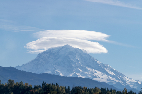
A more relaxed version of both upslope and downslope winds at work is the formation of a lenticular cloud (pictured here). A lenticular cloud appears to stay in one place over the peak of a mountain but what is really happening is the air is constantly flowing up and over the mountain with the cloud being the visible condensed part of this process, similarly to the visible water flowing on top of a rock in a stream.
—
Photo Credit: J A Uppendahl / Shutterstock.com
