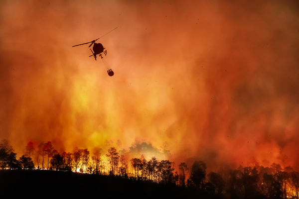
Widespread, long-term drought and the impending Triple Dip La Nina weather pattern has set the stage for another active wildfire season across most of the Western U.S., but the worst of the fires are expected to develop in different areas compared to 2021.
As AccuWeather reports, North American monsoon has provided some drought relief across the Four Corners this summer, and it could have one last gasp before winding down during the second half of September. However, precipitation on a much larger scale will be needed to put a meaningful dent in the long-term drought that has sent water levels in reservoirs across the region down to record-low territory.
Most of the Western U.S. is bone dry amid widespread, extreme drought, so much of the interior West is a tinder box that just needs a single spark to start a fire that can evolve into a raging inferno. Fire season is already underway with several notable wildfires burning throughout the summer months, including the Oak Fire that started in July near Yosemite National Park in California and the McKinney Fire which turned deadly in Northern California. Currently firefighters are battling both the destructive Mosquito Fire in Placerville County (Northern California) and the Fairview Fire in Riverside County (Southern California).
“We are predicting 68,000-72,000 fires and 8.6-8.9 million acres to burn,” explains Senior AccuWeather Meteorologist Paul Pastelok. That forecast is well on its way to being realized with nearly 48,000 fires scorching 6.1 million acres burned as of Aug. 29. This is well ahead of the number of acres burned by the same point in the year in 2021.
Despite the projection of fires burning more land in 2022 than 2021, this fire season is likely to be much different than the last. “Last year, we had incredible heat and dryness in the Northwest and western Canada early in the summer season that just kicked off the fire season,” Pastelok says. It has been cooler with more moisture across much of the Northwest and western Canada this year, which will help to limit wildfire activity this autumn.
Instead, the focal point of the worst of the wildfires this year is predicted to be Southern California, where Pastelok said that “significant fires” could develop by late September into October. “We are expecting a higher number of wildfires for Northern California, southern and eastern Oregon, Idaho, and northern Nevada,” Pastelok added. The highest fire threat in these areas is expected in September through the first half of October.
The Pacific Northwest will be the first to turn the corner and head into the wet season with storms starting to deliver rain and high-elevation mountain snow as early as October. The arrival of these storms will signal the end of the fire season for most of Washington, Oregon and Idaho.
The arrival of storms in October and November will not only be good news for crews battling wildfires but also for skiers anxious to hit the slopes across the Intermountain West. “I believe that there is going to be kind of a mix as far as the ski season goes in the Rockies in the West this year,” Pastelok said.
For resorts in the Pacific Northwest, the start of the ski season may be slightly later than normal as the first storm systems to track across the region may not unload a plethora of snow, but once there is enough snow to build a solid base at ski resorts, the skiing season should be strong well into the winter.
Farther south in the Sierra, it could be a slow start for resorts that rely on natural snow. “I think they’ll get on the normal pace, not the early pace that they saw the last couple of years,” Pastelok said. Snow should arrive in the higher elevations of the Rockies by mid-autumn. However, it will not be smooth sailing after the season’s first flakes as warm weather could limit the accumulation at the base of the mountains until November.
—
Photo Credit: Toa55 / Shutterstock.com
