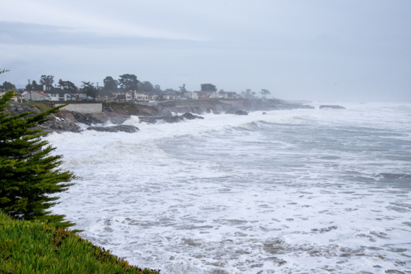
While the Northeastern states continue to deal with unseasonable prolonged drought conditions, a powerful “bomb cyclone” will combine with an atmospheric river to unleash over a month’s worth of rain, hurricane-force wind gusts and feet of mountain snow to parts of the Pacific Northwest and Northern California.
A storm system off the Pacific Northwest was expected to rapidly intensify this week in a phenomenon called “bombogenesis” and earn it the moniker of “bomb cyclone.” It will intensify so much so quickly that it could become a “triple-bomb,” tripling the criteria needed to be considered a bomb cyclone, the National Weather Service (NWS) in San Francisco said.
Bomb cyclones are formidable and unload heavy snow and strong winds during the winter. This one could be among the most intense on record for its location, a storm that occurs only “about once every ten years,” and will generate “some of the strongest winds we have seen in several years” that churn up “very dangerous mountainous seas of 30 to 35 feet,” the National Weather Service in Medford, Oregon, said.
This bomb cyclone will work with an atmospheric river, a long plume of water vapor moving like a river through the atmosphere, to wring out heavy rainfall and significant mountain snowfall in the Pacific Northwest and Northern California beginning Tuesday. The pair will stall along the coast and hammer the area with hazardous conditions through the week and into the weekend.
Parts of northwestern California could record 16 inches of rain or more in 48 hours. More than a month’s worth of rain is expected in the northern San Francisco Bay area, primarily north of the Golden Gate Bridge, the weather service there said. Rainfall of this magnitude is expected to cause significant urban flooding, debris flow on roadways and river flooding.
A level 2 of 4 threat of flooding rainfall is in effect for parts of northwestern California and southwestern Oregon where 2 to 5 inches of rain could fall, the NWS Weather Prediction Center (WPC) said. The heaviest rainfall is expected to begin Wednesday and peak Thursday across northwestern California. A level 3 of 4 risk of flooding rainfall is in effect there for Wednesday and a rare level 4 of 4 high risk is in place for Thursday, according to the WPC.
It’s hard to overstate how big of a deal these high risks are. They are issued on fewer than 4% of days per year on average, but are responsible for more than 80% of all flood-related damage and 40% of all flood-related deaths, research from the WPC shows. Three to 6 inches of rain could fall Wednesday with some spots getting up to 8 inches. Thursday’s rainfall could meet or exceed Wednesday’s totals, especially in the high risk area.
Heavy snowfall is expected across higher elevation areas, where winter weather alerts are in place. Blizzard warnings are in effect across parts of the Washington Cascades, where snowfall over a foot and gusts of up to 60 mph are possible Tuesday afternoon through Wednesday morning. “Travel could be very difficult to impossible. Strong winds could cause extensive damage to trees and power lines,” the NWS office in Seattle warned.
One to 4 feet of snow is possible Tuesday through Wednesday across the Cascades and the northern Sierra Nevada. Snowfall could create impossible travel conditions on Interstate 5 and Highways 31, 36, 66, 89, 97 and 140. Powerful winds will also escalate Tuesday and peak Tuesday night across the region. They will be particularly strong off the coast and rare hurricane-force wind warnings have been issued for much of the coastal waters of the Pacific Northwest.
Widespread winds of 35 to 50 mph are possible inland with tropical storm-force gusts to 70 mph. Isolated gusts in higher elevation areas and across capes and headlands could hit 85 mph, or hurricane-force. These powerful winds could cause potentially widespread power outages and damage to buildings and create difficult travel, especially for high profile vehicles.
Conditions will start to improve by the weekend, but lighter rain could continue into next week.
—
Photo Credit: Rosangela Perry / Shutterstock.com
