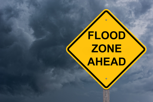
Relentless rounds of heavy rain have inundated parts of the central United States, triggering rapidly rising waterways and prompting multiple flash flood emergencies across several states.
A “generational flood event” refers to a flood of such magnitude and rarity that it’s expected to occur only once in a person’s lifetime or the lifespan of a generation, often characterized by extreme rainfall and widespread, potentially catastrophic flooding.
As CNN Weather reports, overnight into Sunday morning, new tornado warnings were issued in Alabama and Mississippi, while flash flood warnings were in effect for several counties across Kentucky, Mississippi and Tennessee. A flash flood emergency is the highest level of flood warning, only issued when there is a high likelihood of catastrophic damage and a severe threat to human life.
Water rescues continued Saturday, with Sharp County Sheriff Shane Russell reported he personally saved three dogs. Hardy Mayor Ethan Barnes said more than half of the city’s residents are expected to be affected by high water levels this weekend. “We’ve been significantly impacted over the past few days,” A.J. Gary, director of the Arkansas Division of Emergency Management, told CNN Saturday afternoon. As of Sunday morning, some locations in Tennessee and Kentucky have already reported double-digit rainfall totals from the event. Some locations in the mid-Mississippi and Ohio valleys received another round of heavy rain Saturday night.
The flooding comes as communities are still recovering from a deadly outbreak of severe weather earlier in the week, including powerful tornadoes that devastated neighborhoods. At least 16 weather-related deaths have been reported since the start of the storms, including 10 in Tennessee and six others across Missouri, Indiana, Kentucky and Arkansas, according to The Associated Press (AP).
In Little Rock, Arkansas, a 5–year-old was killed in a home battered by severe weather. A Kentucky man was found dead in a submerged vehicle early Saturday, about 30 miles south of Louisville, according to the Nelson County Sheriff’s Office. “A person was trapped in their vehicle in the 2800 block of Nelsonville Road. Responders arrived on the scene to find a vehicle fully submerged. When responders were able to get to the vehicle, the 74-year-old occupant was deceased inside, the sheriff’s office said in a Facebook post, adding “Please do not try to cross flooded roadways. The result does not outweigh the risk. Turn around, don’t drown is more than a saying, it’s the difference between life and death.”
Floodwaters swept a 9-year-old boy away in Frankfurt, Kentucky, while he was walking to a school bus stop Friday morning, bringing the death toll after four grueling days of severe weather to at least seven people. Gabriel Andrews’ body was found about a half-mile from where he went missing, authorities say. “My heart breaks for this family,” Kentucky Gov. Andy Beshear said. “We need everyone to understand that all water poses a risk right now. Let’s do everything possible to keep our loved ones safe.”
All of Kentucky has been impacted by the heavy rain, Beshear posted on X Friday evening, declaring a state of emergency for the western parts of the state. As of Saturday morning, there were more than 390 road closures across the state due to flooding, mudslides and rockslides. “Crews are working hard to get these roadways clear and safe,” Beshear said. “As rain continues to impact Kentucky, please avoid travel if possible and never drive through water.”
Around 200 miles southwest, officials in Hopkinsville, Tennessee, reported that more than half of the downtown area is underwater, swamping homes and cars. “The main arteries through Hopkinsville are probably 2 feet under water,” Christian County Judge-Executive Jerry Gilliam told The Associated Press. “Our office is actually in the middle of it, and we were here before the water rose. So there’s only one way we could get out.”
Tony Kirves tried sandbags and a vacuum to keep destructive floodwaters from flooding his photography business in Hopkinsville. Downtown was “like a lake,” he told The AP. “We’re holding ground. We’re trying to maintain and keep it out the best we can.”
Flash flood emergencies were issued Friday night in at least seven cities in Texas, Arkansas and Missouri, according to the National Weather Service. In East St. Louis, floodwaters covered street after street. Flash flooding due to severe weather that hit several states left vehicles damaged and stranded on the roadways. “It happened so fast,” resident Laqweashia Moore told local news. “Before I started talking to you all, it wasn’t like this, but all that water came out of nowhere and then we saw flash flooding.”
About 200 miles southwest of St. Louis, the West Plains Fire Department responded to several reports of flooding and trapped motorists on Friday evening. About 60 miles east of West Plains, the city of Van Buren was also dealing with intense flash flooding.”Please keep southeastern Missouri in your thoughts tonight as historic and devastating flooding has wreaked havoc over the areas of West Plains, Mountain View and Van Buren which have parts of their towns under water,” the town’s Central Dispatcher Facebook account said and posted a map of dozens of road closures due to flooding.
Farther south, major flooding is hammering Texarkana, Texas, with multiple flood rescues being reported. “Ok, folks. It’s bad out there. We’ve got flooded streets everywhere – and lots more rain on the way,” the Texarkana Police Department posted on Facebook. “Several people have already had to be rescued from their vehicles across the city tonight. We’re just gonna lay it out there…. If you don’t have a darn good reason for being out (like one that involves a visit to the emergency room), please stay home and off the roads!! This is not just another Friday night in Texarkana.”
On Saturday, 521 flights were canceled and more than 6,400 were delayed within the United States or on routes arriving at or departing from the country, according to FlightAware.com. By early Sunday, the site reported 74 cancellations and 478 delays involving U.S. flights.
The powerful atmospheric river with tropical roots continues to soak a 1,000-mile stretch from the southern Plains to the Ohio Valley. Some areas could end up with as much rain in five days as they typically receive in four months.
The additional rounds of torrential rain will continue to trigger widespread, life-threatening and catastrophic flash flooding centered on the mid-Mississippi and Ohio valleys into Sunday. “People across the region need to be prepared for a life-threatening flooding emergency. Relentless rounds of rainfall and back-to-back storms could quickly trigger catastrophic flooding,” AccuWeather Chief Meteorologist Jonathan Porter warned. “This is a rare and dangerous atmospheric setup. The last time AccuWeather warned of a catastrophic risk to lives and property from flooding was ahead of Helene, which brought historic rainfall and devastating flooding to western North Carolina and across the central Appalachians last September.”
Some areas could remain underwater into next week due to additional rounds of rain in the forecast through the weekend. In the next few weeks, runoff from the extreme rainfall will result in moderate to major flooding on the secondary and largest rivers in the region.
—
Photo Credit: Jim Vallee / Shutterstock.com