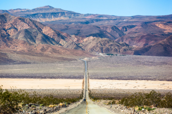
California’s Death Valley could reach a scorching 130 degrees this week and come close to breaking its blistering world record as parts of the West, Southwest and Mid-Atlantic are under an extreme heat wave expected to intensify this weekend.
The temperature at Death Valley National Park, which stretches between eastern California and Nevada, will reach highs around 130 degrees at Furnace Creek, Sunday night through Wednesday, according to the National Weather Service forecast. Furnace Creek, in Inyo County, California, is home to the headquarters for the national park.
The hot weather has already fueled wildfires in California.
The sweltering heat could creep close to the world’s record highest temperature of 134 degrees marked at Greenland Ranch in Death Valley on July 10, 1913, according to the National Weather Service office in Las Vegas. The weather service’s Las Vegas office said Friday’s high temperature at the Furnace Creek Visitor Center was 127, a new record for July 5.
An excessive heat warning is in effect through Wednesday at the park and Las Vegas Valley, and temperatures are expected to be 12 to 14 degrees above the seasonal average. “This heat is very dangerous. Yes, the Mojave Desert gets hot. But this heat will be record-breaking,” NWS Las Vegas warned.
On its web page, Death Valley National Park warned visitors to “minimize time outside in heat.” On Friday, nearly half the nation’s population — more than 158 million people — was under a heat advisory or excessive heat warning, according to the weather service.
Temperatures reached at least 111 in Las Vegas; 106 in Tucson, Arizona; 100 along the border in Del Rio, Texas; 108 in Stockton, California, in the Central Valley east of San Francisco; and 99 in Portland, Oregon. Kingman, Arizona set a new high mark for the date when the reading reached 109, the weather service said. Barstow, California reached its warmest low temperature after sunrise Friday, when the thermometer settled at 85, it said.
High temperatures in the 80s to 100s were expected across the Southeast and Mid-Atlantic, and locations such as Atlanta delivered. That city recorded 94 degrees, but forecasters said the heat index, which includes a “feels like” temperature range usually attributed to humidity, would likely end up in the 100- to 107-degree range. A heat advisory was in effect through sundown.
Saturday will likely be the hottest day of the stretch with highs into the 110s common across California outside coastal areas and naturally cooler higher elevations, the National Weather Service said. However, locally higher temperatures into the 120s are possible in the Desert Southwest. “It is imperative to stay hydrated, out of direct sunlight, and in buildings with sufficient air-conditioning when possible. It is also equally as important to check on the safety of vulnerable friends, family, and neighbors,” the weather service said.
More than 50 cities from the Pacific Northwest to Arizona are expected to break record highs through Wednesday. Las Vegas may come close to breaking its all-time high of 117 degrees for five straight days next week from Sunday to Thursday.
Forecasters blamed a slow-moving high-pressure dome that’s headed from the coast of Northern California to Nevada and the Colorado River Valley. A separate high-pressure dome existed above the Southeast and Mid-Atlantic, with similar effects. A cooler patch of air between the domes could produce some rain in the Ohio and Tennessee valleys overnight, federal forecasters said.
—
Photo Credit: Radoslaw Lecyk / Shutterstock.com
