Bitter cold has plunged much of the eastern two-thirds of the nation into a deep freeze and allowed for some eye-popping low temperatures across parts of the United States over Christmas week. Many cities even experienced the coldest Christmas in decades — and, in some cases, ever. Bottom line: It has been freezing around here. But AccuWeather meteorologists say there’s good news right around the corner. The weather pattern is about to be flipped on its head, and a warmup is in store for the final days of 2022. However, some places will feel relief from the cold much faster than other locations.
“A major shift in the jet stream According to AccuWeather Lead Long-Range Meteorologist Paul Pastelok, there will be a major shift in the jet stream. “Instead of a massive dip in the jet stream that allows air from the North Pole to empty into the U.S., a more west-to-east jet pattern will develop and allow milder air from the Pacific to flow across much of the nation.”
The strong warming trend is likely to be good news for millions of people heading home from holiday destinations or trying to getaway for the new year. Higher temperatures should also help ease the strain on energy demands and on wallets due to high heating costs during the Arctic outbreak.
Portions of the Rockies, Great Plains and Mississippi Valley will experience the most striking and fastest warmup. “As the marine Pacific air flows downhill out of the Rockies and onto the Plains, temperatures will rise quickly and dramatically compared to the frigid conditions in the days prior to Christmas,” Pastelok said.
Farther to the east, cold air may initially put up a little more of a fight, especially from the mid-Atlantic to the southeast corner of the nation. An area of high pressure may hang on in the Northeast and even nose southward a bit during the middle and latter part of the week. “This allows cold air, which is denser than warm air, to remain wedged east of the Appalachians,” Pastelok explained.
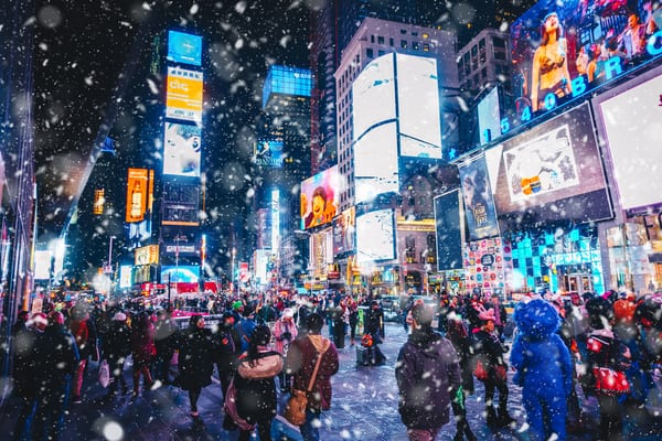
Despite the lingering cold air in the East, the New York City area will experience temperatures recovering into the 40s later in the week, following one of the coldest Christmases since the 1980s. Temperatures could be in the upper 40s and lower 50s for New Year’s Eve revelers at Times Square. The average high in midtown Manhattan on New Year’s Eve is 41 F. Temperatures could even reach 60 by the first afternoon of 2023.
Farther south, in Charlotte, North Carolina, it may take until Thursday or Friday before high temperatures recover to normal levels. A high of 52 is average for early January in the Queen City. Highs in the 60s should be common throughout the Carolinas and Georgia by New Year’s weekend.
The same west-to-east jet stream pattern will allow storms from the Pacific to wander farther south as they move onshore along the West Coast and interior western U.S. This could bring multiple rounds of rain and mountain snow from California to New Mexico and Colorado.
Storms in recent months have delivered some needed moisture to the Southwestern states, and the pattern could bring additional drought-easing precipitation. Vast areas of severe to exceptional long-term drought continue over much of the Western states, according to the latest data from the United States Drought Monitor.
The same pattern could lead to potent storm systems that emerge from the Rockies and travel toward the Mississippi Valley during early January. Much of the Mississippi River basin could benefit from moisture, with the waterway’s recovery sputtering after near-record-low water levels this past summer and autumn.
The pattern could continue to evolve to allow more rounds of severe weather over the South-Central and Southeastern states from late December to early January, AccuWeather Meteorologist Joe Bauer said. “As a warm and moist air flow begins from the Gulf of Mexico and jet stream energy arrives from the Rockies, there may be one or more rounds of heavy, gusty to severe thunderstorms that develop near the Gulf coast to the southern Plains and or the lower Mississippi Valley,” Bauer said.
It is a bit early to pinpoint which precise areas from Texas to Arkansas, Tennessee and Florida might be hit with severe weather and when.
Another potential negative aspect of a warmup that follows an outbreak of Arctic air is the potential for widespread fog. Fog can form when warm, moist air flows over the top of snow cover or cold ground, given the right conditions. A key for driving in dense fog is keeping lights on low beam, and lowering your speed.
—
Photo Credit: Clari Massimilliano / Shutterstock.com