As a fire hose of rain, known as an atmospheric river, continues in western Washington and Oregon, small streams and rivers have become raging torrents, posing significant threats to lives and property throughout the week.
The atmospheric river turned deadly near Portland, Oregon, Monday when a man was swept away along Johnson Creek. A second death was reported Tuesday after a man was recovered from Bronson Creek, also near Portland.
AccuWeather meteorologists reserve the term “atmospheric river” for the most extreme rain and snow events when a long plume of moisture is directed from the ocean to the land, and there is a risk of major travel disruptions or much more serious conditions.
“While atmospheric rivers can vary greatly in size and strength, the average atmospheric river carries an amount of moisture roughly equivalent to the average flow of water of the Mississippi River in southeastern Louisiana,” according to the National Weather Service (NWS). Exceptionally strong atmospheric rivers can transport up to 15 times the average flow of the Mississippi River and extend for thousands of miles.
At times into Wednesday, the rain poured down at the rate of 1-2 inches per hour in some locations. An average rainstorm may bring only that amount of rain throughout its entire duration. Along with the copious amounts of rain, much warmer air is accompanying the atmospheric river, which has already led to quickly melting snow at high elevations in the Olympics and Cascades.
Storms from late last week deposited from 1 to 4 feet of snow on intermediate elevations, which was wiped out in a matter of hours by the atmospheric river.
The combination of melting snow at high elevations with torrential rain will cause small streams and rivers in western parts of Washington and Oregon to run high into Thursday. Even though water levels have crested on most streams and rivers as of Wednesday midday, dangerous conditions and flooding will continue. The banks along some streams could give way without notice due to the raging water and saturated state of the ground.
During the 24- to 48-hour period ending Wednesday night, more than a month’s worth of rain will pour down for many. In some cases, this means that 4-8 inches of rain will fall, enough to lead to street and highway flooding in low-lying and poor-drainage areas. However, when combined with rapidly melting snow from the intermediate and high elevations that have occurred and will continue, the release of water may be the equivalent of 12 inches or more of rain falling. There is an AccuWeather Local StormMax® of 18 inches of rain for this event which is most likely to occur along the west-facing slopes of the Cascades, Coastal Ranges and Olympics.
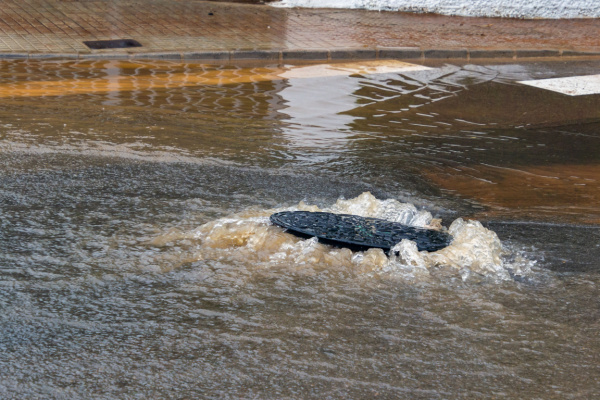
The sudden rainfall will cause the ground to become saturated despite prior drought conditions in the western portions of Washington and Oregon. The land may give way in some cases, leading to rockslides, debris flows and road washouts. Residents are advised to stay home and off the roadways if possible.
—
Photo Credit: Fernando Astasio Avila / Shutterstock.com
