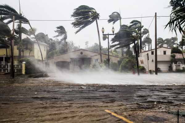
AccuWeather meteorologists continue to warn about a surge of tropical activity and direct threats to the southeastern United States as the heart of the hurricane season looms, despite a long gap in tropical development over the Atlantic this summer.
Atlantic tropical activity this year has been slower than in recent seasons and there has not been a single hurricane in the basin since the season started on June 1. In fact, according to AccuWeather hurricane Expert Dan Kottlowski, if there are no tropical storms or hurricanes in August, it will be the first time that’s happened since 1997 and just the third time on record.
After the formation of tropical storms Alex, Bonnie and Colin, there hasn’t been a single tropical depression or storm in the Atlantic since July 2. One system, classified as a tropical rainstorm by AccuWeather forecasters, nearly formed over the western Gulf of Mexico during the second weekend of August, but it eventually moved over South Texas before it could organize further.
August typically marks a rapid increase in the number of tropical storms and hurricanes and that trend usually persists well into September, with the climatological peak of the season occurring on Sept. 10. However, since the uptick is getting a later start than average, Kottlowski’s team of tropical weather experts is making a minor adjustment to its original forecast that was issued earlier this spring.
AccuWeather meteorologists expect there to be 16 named storms, including the three that have already developed. The original forecast called for 16-20 named storms. The forecast for the number of hurricanes remains unchanged and calls for six to eight hurricanes and three to five major hurricanes this season. “Our thinking has not changed as far as 2022 still being an active season,” Kottlowski said. “Our biggest concern is for a high chance for high-impact hurricanes.”
A normal number of named storms based on the 30-year average from 1991 to 2020 is 14, while a normal number of hurricanes during a season is around seven.
According to AccuWeather, a vast area of dry air and stiff breezes, known as wind shear has persisted much of this summer from the central Caribbean to the central and eastern Atlantic. These conditions have created an environment too hostile for tropical development of the disturbances, known as tropical waves, that routinely move west off the coast of Africa.
Two of the tropical storms brought direct impacts to the southeastern U.S. Even though Alex was not officially named a tropical storm until after it had passed Florida, the system brought torrential downpours and flooding to parts of South Florida Tropical Storm Colin brought locally heavy rain and gusty thunderstorms to coastal areas of the Carolinas before it dissipated.
A large area of high pressure, known as the Bermuda high, has weakened somewhat but is still expected to extend into the southeastern U.S. frequently similar to last season, Kottlowski explained. “This could still drive tropical activity into the Caribbean and the U.S,” he said.
Earlier in August, Kottlowski noted that conditions less hostile for tropical waves were developing over Africa and that these “friendly” conditions for tropical development would drift over part of the western Atlantic next week. Once this occurs, tropical waves that have been suppressed thus far may begin to show more vigor due to less dry air and lower wind shear.
Initially, some of these storms that evolve may curve over the central Atlantic and steer clear of the U.S., but that too may change as the season continues. “We continue to be impressed by the potential for a significant surge in tropical activity during the heart of the hurricane season and with the potential for the season to run long this year,” AccuWeather Chief Meteorologist Jonathan Porter said.
—
Photo Credit: FotoKina / Shutterstock.com
