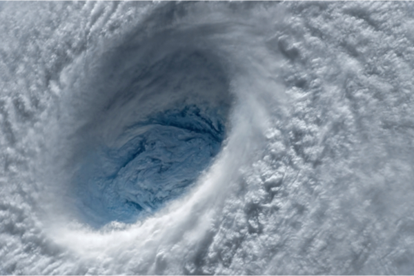
With the ongoing effects of climate change being seen all over the planet, causing more severe and extreme weather events that we’ve never before experienced, the Category 4 and 5 Hurricanes, where winds can top 160 to 180 mph, are now predicted not to be the max that might be headed our way. In light of that sobering fact, CNN reports that the National Science Foundation (NSF) just awarded a $12.8 million grant to Florida International University (FIU) and its Extreme Events Institute for the design of a full-scale testing facility capable of producing winds of 200 mph, along with a water basin to simulate storm surge and wave action in extreme winds.
FIU will be able to build a house under the current building codes, start up the fans and see if it can withstand 200 mph winds. Will the roof detach? Will the house still be standing at all? The water basin will look like an enormous pool. It will also be able to simulate different coastlines. Storm surge tends to be worse when the coastlines are more shallow like along the Florida Panhandle. The facility will be able to simulate all of it.
“If you think about trying to future-proof, a changing hazard environment, a hazard scape, the US hazard scape with climate change, the past is not much of a guide. In fact, it can be deceiving,” said Dr. Richard Olson, director of the Extreme Events Institute at FIU. “So, if we’re going to future-proof, we need to be able to research and test what future hazard events will look like. You can’t future-proof in a changing environment if you’re looking backwards.”
Tropical Cyclones are Getting Stronger
According to CNN, climate change is showing us storms are getting stronger, moving slower and are holding more water than ever before. They are also rapidly intensifying, meaning the winds are increasing at least 35 mph in a 24-hour period. In 2021, five hurricanes in the Atlantic rapidly intensified. And in 2020, TEN Atlantic hurricanes rapidly intensified. “The scientific consensus is that we’re going to see more intense storms, so we have to research and test for more intense storms,” said Olson. “Otherwise, nature’s going to keep hitting us with harder stuff than we’re ready for.”
The facility will be the first of its kind in the world to combine wind speeds of greater magnitude along with a water component. Eventually the facility will be able to test how different types of infrastructure, roads, bridges will all respond with a Category 6 storm.
“We can start putting all of these components together to get a much better picture of what nature is going to be hitting us with,” says Olson. Since 2010, there have been 18 storms globally with recorded wind speeds of at least 178 mph at some point during their life span. Irma in 2017 and Dorian in 2019 were two storms in the Atlantic to meet the threshold.
It begs the question, especially for messaging purposes, do these types of storms need a special name? Category 6? Super-hurricane? Just something to put an exclamation point on how intense these specific storms are. But the truth of the matter is, most people who die in hurricanes don’t die from wind, but from water.
In an interview with CNN, Dennis Feltgen, the public affairs officer at the National Hurricane Center (NHC) spoke about whether he thought there would ever be a day in our future we would see a Category 6, and here is what he had to say:
“NHC has tried to steer the focus toward the individual hazards, which include storm surge, wind, rainfall, tornadoes and rip currents, instead of the particular category of the storm, which only provides information about the hazard from wind. Category 5 on the Saffir-Simpson Hurricane Wind Scale already captures ‘Catastrophic Damage’ from wind, so it’s not clear that there would be a need for another category even if storms were to get stronger. In addition, most deaths in tropical cyclones occur not from the wind but from water — storm surge, rainfall/inland flooding, and hazardous surf — causing about 90 percent of tropical cyclone deaths in the United States. So, we don’t want to overemphasize the wind hazard by placing too much emphasis on the category.”
As storms become stronger, wetter and slower, there might be a day the category system evolves from what it is now, just as the EF scale or Fujita scale was enhanced in 2007. And by the way, the same facility will also test tornado and thunderstorm winds.
There are a few research facilities studying extreme winds. “I think the interaction between the various components of hurricanes, the waves, the flooding, the currents, and the wind, the debris, all of that, it’s very important to simulate that as practically as possible,” said Dr. Arindam Gan Chowdhury, professor of environmental engineering at FIU. “Everything is not possible to replicate Mother Nature. But the closer we can get, the better we can learn.”
FIU along with seven other universities will partner in this endeavor. You can read the full news release from FIU here.
—
Photo Credit: Evgeniyqw / Shutterstock.com
Photo Credit: Evgeniyqw / Shutterstock.com
