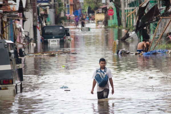
AccuWeather meteorologists report that the Western Pacific Ocean is experiencing a surge in tropical activity this week, with four storms stretching from Vietnam to the Mariana Islands. After two typhoons hit the Philippines Thursday and Monday, two additional typhoons are poised to potentially impact the area late this week and early next week.
The previous three storms — Typhoon Yinxing, Typhoon Kong-rey and Tropical Storm Trami — left more than 160 people dead and affected over 9 million people in the Philippines with extreme flooding, according to The Associated Press (AP).
Typhoon Usagi/Ofel
A new storm, known as Tropical Depression 27W earlier Monday, strengthened into Tropical Storm Usagi, known as Ofel in the Philippines, Monday night. Usagi will become a typhoon on Tuesday night, Nov. 12, and additional strengthening is expected as it tracks west-northwest starting Wednesday. Usagi/Ofel is expected to produce rainfall up to 12 inches (300 mm) with an AccuWeather Local StormMax™ of 18 inches (450 mm) across Luzon Thursday, Nov. 14, into Saturday, Nov. 16. This rainfall can produce flooding, mudslides and transportation delays.
Usagi/Ofel is expected to produce wind gusts to 100 mph (160 km/h) with an AccuWeather Local StormMax™ of 120 mph (190 km/h) across northern and eastern Luzon. These winds can produce power outages, structural damage and logistical delays. AccuWeather meteorologists say the due to the expected rain and wind, Usagi/Ofel is a 2 on the AccuWeather RealImpact™ Scale in the Philippines.
Typhoon Man-yi
After Typhoon Usagi, Tropical Storm Man-yi will continue to track westward over the next several days, bringing heavy rain and strong wind gusts to Guam and the Northern Mariana Islands Tuesday night and Wednesday, local time.
Man-yi will strengthen to a typhoon over the Philippine Sea late this week and may eventually impact the northern Philippines later this weekend or early next week. Man-yi is expected to produce rainfall up to 12 inches (300 mm) across Luzon Sunday, Nov. 17, and Monday, Nov. 18, with an AccuWeather Local StormMax™of 18 inches (450 mm). This rain can result in additional flooding, mudslides and transportation delays.
Man-yi can produce wind gusts to 120 mph (190 km/h) across Luzon with an AccuWeather Local StormMax™ of 140 mph (225 km/h) Sunday through Monday. These winds can produce power outages, structural damage and logistical delays. Due to the expected rain and wind, Man-yi will be a 3 on the AccuWeather RealImpact™ Scale in the Philippines. If Man-yi impacts the northern Philippines, it would make for four tropical impacts on the area in 10 days.
Where are Typhoons Toraji/Nika and Yinxing/Marce Now?
Typhoon Toraji, known as Nika in the Philippines, made landfall in the northern province of Aurora in the Philippines Monday morning. Tropical Storm Toraji is tracking northwestward over the South China Sea and is expected to slow and turn west to southwest Tuesday night, Nov. 12, and Wednesday, Nov. 13. Toraji can maintain intensity into Wednesday, then should lose wind intensity. The storm should remain far enough offshore to have no significant impacts on southern China or any other landmasses.
Yinxing, known as Marce in the Philippines, is now fading over southern Vietnam. When the storm made landfall in the Philippines last Thursday, it was a violent typhoon.
What’s the difference between a Typhoon and a Hurricane?
Hurricanes and typhoons are the same weather phenomenon: tropical cyclones. A tropical cyclone is a generic term used by meteorologists to describe a rotating, organized system of clouds and thunderstorms that originates over tropical or subtropical waters and has closed, low-level circulation.
The weakest tropical cyclones are called tropical depressions. If a depression intensifies such that its maximum sustained winds reach 39 miles per hour, the tropical cyclone becomes a tropical storm. Once a tropical cyclone reaches maximum sustained winds of 74 miles per hour or higher, it is then classified as a hurricane, typhoon, or tropical cyclone, depending upon where the storm originates in the world. In the North Atlantic, central North Pacific, and eastern North Pacific, the term hurricane is used. The same type of disturbance in the Northwest Pacific is called a typhoon. Meanwhile, in the South Pacific and Indian Ocean, the generic term tropical cyclone is used, regardless of the strength of the wind associated with the weather system.
The ingredients for tropical cyclones include a pre-existing weather disturbance, warm tropical oceans, moisture, and relatively light winds. If the right conditions persist long enough, they can combine to produce the violent winds, large waves, torrential rains, and floods we associate with this phenomenon. At times, when a weather system does not meet all of these conditions, but is forecast to bring tropical storm or hurricane force winds to land in the next day or two, it is called a potential tropical cyclone in the Atlantic basin and the central and eastern North Pacific basins.
The Philippines is impacted by an average of 20 typhoons a year. So far this year, they have been hit by eight storms. Although the previous three typhoon seasons were below normal in the Western Pacific, this year is definitely well above normal, with 25 storms so far this season that have caused $25.2 billion in damage, ranking this season the fifth most expensive.
—
Photo Credit: at.rma / Shutterstock.com
