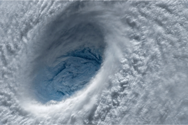
Forecasters are predicting a busy Atlantic hurricane season over the next three months, as a summer of climate change-fueled extreme weather continues. August, September and October account for an average of 85% of hurricane formation and record-high ocean temperatures may fuel more, and more severe, hurricanes this year.
As Yahoo News reports, meteorologists at Colorado State University released a report on August 3 that forecasted 18 named storms, including nine hurricanes, and four major hurricanes will occur this year. The CSU research team previously upped their projections twice this year due to “extreme anomalous warmth” of ocean temperatures.
“Please get your hurricane plan in place because we could get very active in late August into September,” AccuWeather meteorologist Dan Kottlowski said.
How Hurricanes Form
Hurricanes start as cyclones, which are described by the National Oceanic and Atmospheric Administration (NOAA) as “a rotating, organized system of clouds and thunderstorms that originates over tropical or subtropical waters.” Cyclones are formed in tropical regions, and when a tropical cyclone surpasses wind speeds of 39 miles per hour it becomes a tropical storm and receives a name. At 74 mph it is designated a hurricane if it is in the North Atlantic, central North Pacific or eastern North Pacific. (In other regions, it is classified as a typhoon or tropical cyclone.)
About Hurricane Season
For the Atlantic Ocean, hurricane season runs from June 1 through Nov. 30, when 97% of tropical cyclone activity occurs. The largest number of tropical cyclones, especially the strongest ones that turn into hurricanes, occur in August through October.
A number of factors contribute to making that time the peak hurricane season, according to the Weather Channel:
- African easterly waves, which seed hurricanes and add moisture to dry air from the Sahara Desert, are strongest.
- Sea-surface temperatures, which provide energy for hurricanes, keep gradually warming over the course of summer.
- The atmosphere’s ability to create thunderstorms also peaks in early fall, while changes in the speed or direction of wind, “which can rip apart a tropical cyclone,” are low at that time of year.
The Hot Summer & El Nino Likely to Make it Worse in 2023
June was the hottest June on record, and July was the hottest month on record, period. Multiple days in July set new record average global temperatures. That heat is being captured in the oceans. Last Wednesday, a buoy in Manatee Bay just off the coast southwestern Florida registered an ocean temperature of 101.1 degrees Fahrenheit — the hottest ocean temperature in recorded history.
Higher temperatures have other effects being seen worldwide, including earlier, longer and more severe wildfires, and — because warmer air holds more moisture — heavier rainfall. Since warm ocean waters and thunderstorms power hurricanes, these conditions increase the likelihood and severity of hurricanes.
While the average year sees 14 named storms, AccuWeather recently upped its forecast from 11 to 15 named storms to 13 to 17 this year, including four to eight hurricanes, due to high sea-surface temperatures.
In addition to climate change, one reason this year is especially hot is El Nino, a band of warm ocean water that develops in the Pacific Ocean. El Nino increases upper-level westerly winds across the Caribbean into the tropical Atlantic, which in turn increases wind shear and therefore may impede hurricane development.
“This year’s extreme warmth in the tropical Atlantic is a very favorable environment for tropical development. Will it be enough to overcome El Nino-caused shear?” reported CBS News Miami on Friday. “We just don’t know. This is why it’s a particularly difficult forecast.”
—
Photo Credit: Evgeniyqw / Shutterstock.com
