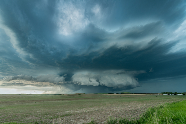
If you’ve been watching the weather news lately, you’ve already noticed that tornado season is here, and it’s wreaking havoc across the country. You may also have seen “storm chasers,” or “spotters,” out trying to capture the latest event on film. Which leads one to wonder, “what do storm spotters look for?”
According to the NOAA National Severe Storms Laboratory (NSSL), when a storm spotter is scanning the skies and/or checking their equipment, this is what they’re trying to decipher:
Inflow bands are ragged bands of low cumulus clouds extending from the main storm tower usually to the southeast or south. The presence of inflow bands suggests that the storm is gathering low-level air from several miles away. If the inflow bands have a spiraling nature to them, it suggests the presence of rotation.
The beaver’s tail is a smooth, flat cloud band extending from the eastern edge of the rain-free base to the east or northeast. It usually skirts around the southern edge of the precipitation area. It also suggests the presence of rotation.
A wall cloud is an isolated cloud lowering attached to the rain-free base of the thunderstorm. The wall cloud is usually to the rear of the visible precipitation area. A wall cloud that may produce a tornado can exist for 10–20 minutes before a tornado appears, but not always. A wall cloud may also persistently rotate (often visibly), have strong surface winds flowing into it, and may have rapid vertical motion indicated by small cloud elements quickly rising into the rain-free base.
As the storm intensifies, the updraft draws in low-level air from several miles around. Some low-level air is pulled into the updraft from the rain area. This rain-cooled air is very humid; the moisture in the rain-cooled air quickly condenses below the rain-free base to form the wall cloud.
The rear flank downdraft (RFD) is a downward rush of air on the back side of the storm that descends along with the tornado. The RFD looks like a “clear slot” or “bright slot” just to the rear (southwest) of the wall cloud. It can also look like curtains of rain wrapping around the cloud base circulation. The RFD causes gusty surface winds that occasionally have embedded downbursts. The rear flank downdraft is the motion in the storm that causes the hook echo feature on radar.
A condensation funnel is made up of water droplets and extends downward from the base of the thunderstorm. If it is in contact with the ground it is a tornado; otherwise it is a funnel cloud. Dust and debris beneath the condensation funnel confirm a tornado’s presence.
If you’re thinking of becoming a Storm Spotter/Chaser, BE CAREFUL! Tornadoes can form and be in contact with the ground without a fully condensed funnel!
An excellent comprehensive list of questions and answers about tornadoes can be found by visiting the NOAA NSSL website.
—
Photo Credit: Joe Belanger / Shutterstock.com
